Rundwanderweg Nr. 4 durch das Brakeler Bergland von Brakel über Bökendorf und Bellersen wieder zurück nach Brakel auf den Spuren von Annette von Droste Hülshoff


- 8:15 h
- 25.46 km
- 362 m
- 356 m
- 132 m
- 296 m
- 164 m
- Start: Brakel, parking lot no. 9, on Bredenweg
- Destination: Brakel
Circular hiking trail no. 4, Brakel-Bökendorf-Bellersen-Brakel
This circular hiking trail takes you through Bökendorf and the model tourist village of Bellersen.
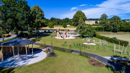
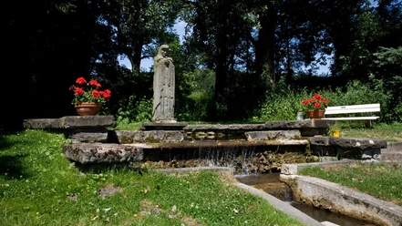
The hiking trail starts at the car park at the Kaiserbrunnen fountain in Brakel. You walk along the cemetery of honour.
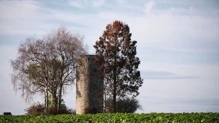
First you walk along the outside of the cemetery or along the edge of the forest. Then you walk uphill in the forest until you reach the tarmac path. A few metres to the left is the Schneekapelle chapel. It dates back to 1844 and is dedicated to the Virgin Mary.
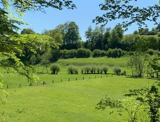
If you don't want to visit the chapel, cross the tarmac path and continue straight ahead through the forest. You leave the forest and before you lies the wide Bökendorf valley, which continues southwards via Hainhausen and Modexen. Beyond the valley, the Bökerberg, Wüllenberg and Modexer Holz form an impressive backdrop.
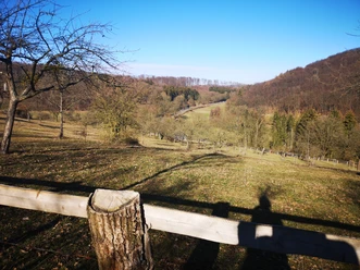
Now walk down to Bökendorf, cross the village first mentioned in 965 and follow the Höxterschen Weg uphill into the Feldmark to the height of the Wüllenberg. From this high point, you can see Bökendorf in the valley, Bellersen further to the west and the Abbenburg estate to the north. In front of you is the historical setting of Annette von Droste Hülshoff's "The Jew's Beech".
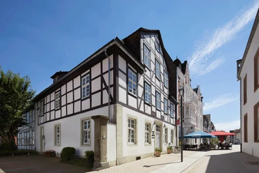
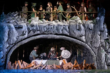
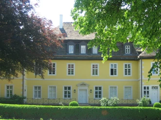
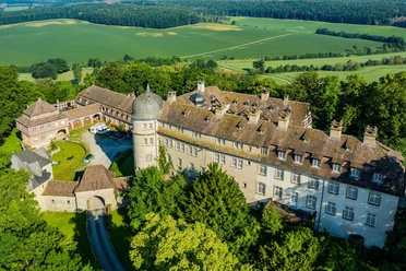
Once you have enjoyed the impressive view, continue into the forest and take the turn-off to the left. The circular hiking trail leads you onto a field path near the edge of the forest. From there you walk down into the valley and pass the open-air theatre. A visit to a theatre performance is worthwhile whatever the weather. You can also visit Bökerhof Castle and walk along the arcade used by Annette von Droste Hülshoff and the Brothers Grimm.
After leaving the arcade, the path leads you along Lindenallee and Kreuzweg to the forest, Lämmerkamp. Follow the hiking trail in the forest and when you come out into the open, you will have a view of the wide fields of Bellersen.
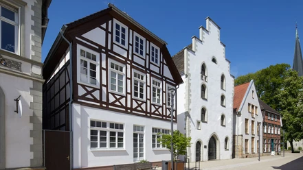
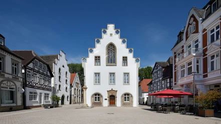
Bellersen has been a model tourist village of the state of North Rhine-Westphalia since 1992. Take a closer look at the village and discover the hiking route, the agricultural history circular hiking trail, the sensory experience trail and the many beautiful sights along the way. Once you have visited Bellersen and perhaps had some refreshments, leave the village south of Mühlenkrug and the motorhome harbour via a narrow bridge. Now you walk along the lower slopes of the Rammelsberg. Enjoy the view of the Brucht valley.
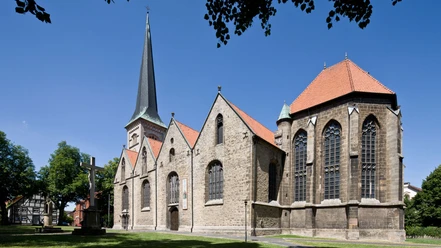
The trail leads you, always along the valley slope, through the forest, past the Sengenthal forester's lodge towards Brakel. Then the trail slowly climbs again to the ridge on which the Hinnenburg castle towers. Descend to the Kaiserbrunnen fountain and return to your starting point on the familiar path.


Waypoints

Good to know
Pavements
Best to visit
Directions
The hiking trail starts at the Bredenweg parking lot. First you walk along the Brucht and then along Kreisferienstraße, which you cross at the traffic lights and then turn left into Heinefelder Weg to reach the Kaiserbrunnen fountain. Walk past the Trinkhalle and through the Kurpark to the cemetery of honor. First you walk along the outside of the cemetery or along the edge of the forest, then it goes uphill in the forest.
On reaching the asphalt path from Schäferhof to Hainhausen, cross the path and continue straight ahead. This will take you to Bökendorf (at the small chapel, turn right), to Wullhof. Walk along Dreizehnlindenstraße towards the center of the village and then turn right onto Höxterscher Weg. Continue half right on the next path until a path bends sharply to the right, which you follow up to the top.
Continue into the forest and take the fork to the left. Now follow the edge of the forest in a wide arc until you reach a group of large beech trees. The path leads over the heights to Bökendorf, always close to the forest, first to the north and then to the northwest. You now walk through the fields in the direction of Bökendorf. Then follow a grassy path that turns off to the right at an acute angle and descend into the valley, cross the main road and walk through the avenue to Bökerhof Castle. There, turn west and walk past the tennis court through the arcade, then along Lindenallee and Kreuzweg to the forest.
In the forest, follow the path until it turns right at an acute angle, turn right and then go straight ahead. At the first barn, turn left into Mühlengrund and come to the old mill. Walk south there, past the motorhome port and cross the Brucht over a narrow bridge.
Now walk along the lower slope of the Rammelsberg. Your path leads you through the forest straight ahead to the south. It soon bends to the south-east and slowly begins the ascent to the ridge. At the top, you cross the chestnut avenue from the castle to the Schneekapelle chapel. Now descend the hill to the Kaiserbrunnen fountain. You return to your starting point, the parking lot on Bredenweg, via the familiar path.Tour information
Familiy-Friendly
Loop Road
Stop at an Inn
Equipment
Directions & Parking facilities
From Paderborn via the B 64 federal highway to the Brakel junction
Ostwestfalenstraße 252 coming from Lemgo take the 1st exit, coming from Warburg take the 3rd exit Brakel. Follow Nieheimer Straße until the 1st junction, then turn left onto Bredenweg. The parking lot is on the left-hand side.
Additional information
Tourist-Info, Am Markt 5, 33034 Brakel, 05272 - 360 - 1250 , tourist-info@brakel.de
Contact person
Tourist Information Brakel
License (master data)
Tourist Information Brakel

Map
Download GPX file
Photo Gallery


