NSG Warmenau


The Warmenau, a small river nearly 19 km long, flows through the Warmenau-Strangfeld Nature Reserve, still unregulated and following its natural curves and meanders. It forms the border between Lower Saxony and North Rhine-Westphalia. Regular flooding continues to shape the riverside landscape—the floodplain—to this day. Fine sand, silt, and mud are deposited by the floodwaters on the floodplain meadows, fertilizing them. This also enhances the Warmenau’s natural purifying power. The meadows in the Warmenau floodplain, along with the small bodies of water found here, have taken the place of the floodplain forests cleared by humans and the oxbow lakes that have since disappeared. Riparian zones with willow trees, small standing bodies of water, and meadows provide diverse habitats for animals and plants. There are two information signs in the Warmenau Nature Reserve that provide on-site information to interested visitors.

Good to know
Payment methods
- Entrance Free
License (master data)

Nearby



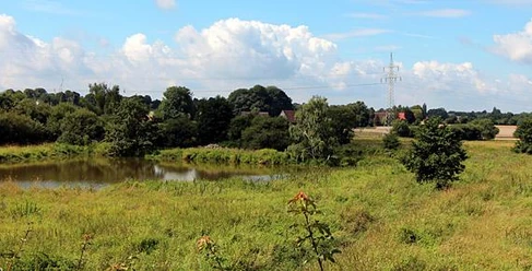
Photo Gallery