Sennebach - Sennebäche in Schloß Holte-Stukenbrock


The 25.6-kilometre-long Sennebach rises as the Rahmkebach north of Augustdorfer Straße, just outside the municipality of Augustdorf. On its way through the urban area of Schloß Holte-Stukenbrock in the Stukenbrock-Senne district, it briefly flows through the Schluchten und Moore nature reserve on the upper Furlbach, is dammed on the grounds of the Senne Golf Club Gut Welschof and then continues north of Safariland Stukenbrock towards Hövelhof. After around five kilometers, the Rahmkebach finally changes its name to Sennebach. As Sennebach, it first enters Hövelhof territory for a short distance before flowing back into the Schloss Holte-Stukenbrock urban area through the south of the Liemke district. After leaving the urban area, the Sennebach continues its course through the towns of Verl and Rietberg. It then flows into the Ems in Rietberg.
Good to know
Other Furnishing/Equipment
cool place
Directions & Parking facilities
The Bielefeld - Paderborn train line takes you directly to Schloß Holte-Stukenbrock.
You can find your travel options by public transport via OWL-Verkehr https://teutoowl.de/owlv/.
Schloß Holte-Stukenbrock is easily accessible by car via the A33 highway with two highway exits (Schloß Holte-Stukenbrock and Stukenbrock-Senne).
https://www.owlmobil.info/app/ App for various mobility offers
Social Media
License (master data)
Stadtverwaltung Schloß Holte-Stukenbrock

Nearby


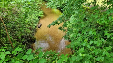
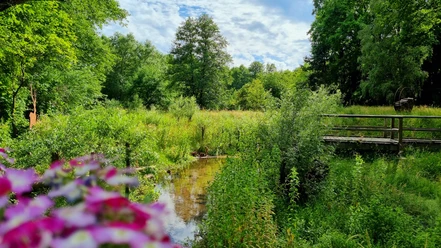


Photo Gallery