- 3:30 h
- 12.77 km
- Start: Parking lot Verler Landstraße, Schloß Holte
- Destination: Parking lot Verler Landstraße, Schloß Holte
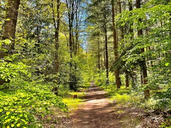
First, the route leads through woods and fields, along the Landerbach stream. Past riding facilities and nature reserves, you reach the Wester-Ebbinghaus farm. There, the Landerbach flows into the Ölbach. From here, the route follows the Ölbach back to the edge of the Holter Wald forest, where the Mühlcafé is located.
Good to know
Best to visit
Directions
Tour information
Familiy-Friendly
Labelling
Loop Road
Stop at an Inn
Suitable for Winter
Tour with Dog
Equipment
Directions & Parking facilities
Senne-Bahn Bielefeld - Paderborn: Schloß Holte station (1.7 km).
Bus route 83 Schloß Holte > Bielefeld > Schloß Holte: "Schloßkrug" bus stop.
Always know what's running: The smart number for buses and trains in NRW: 01806 504030 (20 cents/connection from landlines and a maximum of 60 cents/connection from mobile networks.)
Additional information
The hiking trail is included in the free city map of Schloß Holte-Stukenbrock
.Literature
License (master data)
Stadtmarketing Schloß Holte-Stukenbrock
Author´s Tip / Recommendation of the author
The Mühlcafè is a very comfortable place to sit, both outside on the terrace by the mill wheel and inside in the cozy dining room.
Want to end the day in the beer garden? Get in touch with the Holter Schlosskrug!
Safety guidelines
Map
Town map of the town of Schloß Holte-Stukenbrock including cycling and hiking trails, available by calling 05207 89050 or stadtmarketing@stadt-shs.de.


