Wapelbach im Wapelweg - Sennebäche in Schloß Holte-Stukenbrock


The Wapelbach has its source to the east of Stukenbrock and first crosses the Wehrbachtal nature reserve, which has existed since 1990. This is why it is still called Wehrbach here. Only after a few kilometers does it change its name to "Wapelbach", flows as such through the town of Schloß Holte-Stukenbrock and leaves the urban area in the direction of Verl. From the confluence with Rodenbach, the name changes again and the Wapelbach becomes the "Wapel". In its further course, the Wapel then passes Rietberg, Rheda-Wiedenbrück and the city of Gütersloh. There, the almost 36 km long river joins the Dalke, which then flows into the Ems. The Wapel, like the Rodenbach, is particularly worthy of protection due to the occurrence of the nationally endangered fish and roundmouth species bullhead and brook lamprey and its equally endangered habitat type "alder, ash and softwood alluvial forests".
Good to know
General information
Bus stop available
Other Furnishing/Equipment
cool place
Directions & Parking facilities
The Bielefeld - Paderborn train line takes you directly to Schloß Holte-Stukenbrock.
You can find your travel options by public transport via OWL-Verkehr https://teutoowl.de/owlv/.
Schloß Holte-Stukenbrock is easily accessible by car via the A33 highway with two highway exits (Schloß Holte-Stukenbrock and Stukenbrock-Senne).
https://www.owlmobil.info/app/ App for various mobility offers
License (master data)
Stadtverwaltung Schloß Holte-Stukenbrock

Nearby


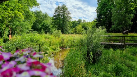
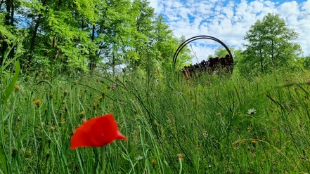


Photo Gallery