Hermannshöhen - Etappe 08 von Oerlinghausen zum Hermannsdenkmal
.JPG")


- 5:00 h
- 17.94 km
- 383 m
- 249 m
- 160 m
- 379 m
- 219 m
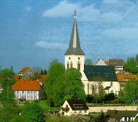
- Start: Oerlinghausen Church
- Destination: Hermann monument near Detmold
The stage at a glance:
1. Start and finish point of the stage
2. Length of the stage in kilometers / elevation gain / route character
3. Scenic features
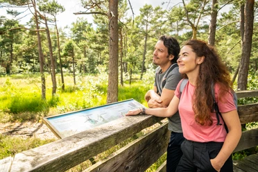
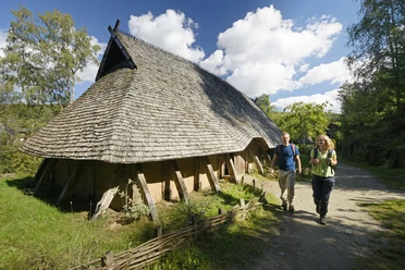
Highlights on the route
- An old windmill stump, the "Kumsttonne" (Kumst = cabbage) on the Tönsberg is the landmark of Oerlinghausen. The mill was built in 1753 and lost its wings in a storm and remained standing on the hill in this condition.
- The imposing memorial was erected in 1930 as a Memorial of Honor in memory of the fallen soldiers of the Royal Infantry Regiment No. 145. Today, this place is a reminder of peace and reconciliation and is an important historical monument in the region.
- At two listening stations in Oerlinghausen, Anna & Hermann tell exciting stories about the town. The first listening station is located at the Kumsttonne and another at the Lönsstein. The second listening station tells you exciting facts about gliders. A third audio station on the route is located in Lage-Hörste.
- The Rethlager springs - a natural monument on the Hermannsweg - are karst springs that carry very cold water all year round. They are located on the northern slope of the Teutoburg Forest on the edge of the Dörenschlucht gorge. The Rethlage rises at this point and flows into the Werre on its further course.
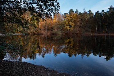
- The Donoper Teich nature reserve is a popular destination for hikers, walkers and families. The area is an important habitat for many rare animal and plant species and offers a breathtaking natural backdrop. The Donop pond used to be used for fish farming. Even today, you can still observe various species of fish from the shore.
- The Hiddeser Bent (Bent = peaty moor) is a nature reserve and is the last surviving hillside moor in the Teutoburg Forest. Here you can discover many rare plant species, including 13 different types of peat moss. There is a viewing platform on the northern edge of the bog, which offers sweeping views across the moor.
- The Hermannsdenkmal on the 356 m high Grotenburg in Hiddesen is probably the most famous excursion destination in the Teutoburg Forest. It was built to commemorate the "Battle of the Teutoburg Forest" and is an impressive monument with a total height of 54 m. Tip: You have a great view of the landscape from the monument's viewing platform.
A good interactive tour map for the stage can be found here


Waypoints

Good to know
Pavements
Best to visit
Directions
If necessary, use the ZAugangsweg Lage-Hörsteto descend early.
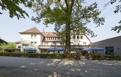
Our quality establishment of the Hermannshöhen in stage proximity:
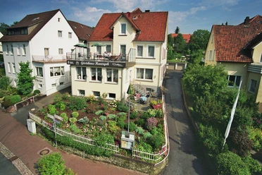
- Hotel Landhaus Hirschsprung, Detmold
www.landhaus-hirschsprung.de, Tel. 05231-8785000 - Pension Haus Berkenkamp Lage-Hörste
www.haus-berkenkamp.de; Tel.: 05232 71178 - Hotel Mügge am Iberg
www.hotel-muegge.de; Tel 05202 - 3599
Tour information
Cultural Interesting
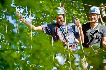
Familiy-Friendly
Possibility of Accommodation
Premium Trail "Wanderbares Deutschland"
Stop at an Inn
Tour with Dog
Equipment
Please take plenty of provisions with you on the route, which has only a few places to stop for refreshments and ends with a steep climb!
Don't forget: Binoculars and camera. Hiking boots are useful.
Directions & Parking facilities
Parking lot Marktplatz Oerlinghausen
Marktstraße 16, 33813 Oerlinghausen
approx. 350 m to the path
Bus stopMarktplatz
39 BI-Sennestadt - BHF Oerlinghausen
38 Oerlinghausen - Stieghorst Zentrum (Stadtbahn)
Parking along the route:
Parking Welschenweg
Freibad Oerlinghausen
Welschenweg 108, 33813 Oerlinghausen
approx. 450 m to the path
No connection to local transport available!
Wanderparkplatz Bienenschmidt
Kalkreute 100, 32791 Lage
approx. 50 m to the trail
No connection to public transport available!
Am Fischerteich 12, 32758 Detmold
direkt am Weg
Bus stopSandstraße
390 Augustdorf - Pivitsheide - Detmold BHF
Schedule information
Wanderparkplatz Donoper Teich
Stoddartstraße 336, 32760 Detmold
directly on the way
No connection to local transport available!
Heidentalstraße 52A, 32760 Detmold
50 m to the trail
Bus stopMaiweg
792 Bad Pyrmont - Externst. - Detmold (seasonal)
Parking lot at Hermannsdenkmal (chargeable)
Grotenburg 2, 32760 Detmold
approx. 50 m to the path
Bus stop Hermannsdenkmal
792 Bad Pyrmont - Externst. - Detmold (seasonal)
The smart number for bus and train in NRW:
Electronic timetable information: 08006 - 50 40 30 (free of charge)
OWL Verkehr GmbH: 05231/977 681
Bus timetable information online: westfalentarif.de
Additional information
License (master data)

Author´s Tip / Recommendation of the author
Our recommendations

Photo Gallery


