- 4:00 h
- 43.20 km
- 282 m
- 275 m
- 108 m
- 230 m
- 122 m
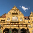
- Start: New Town Hall Bielefeld , Niederwall 23
- Destination: New Bielefeld Town Hall, Niederwall 23
The scenic route takes you to architectural highlights and magnificent natural beauty.
The buildings on Ravensberger Straße between "Anker-Brücke" (house no. 12) and Teutoburger Straße give you an idea of the old face of the city. Look out for the ravens at house no. 63! They are reminiscent of the namesake of the county of Ravensberg, whose capital was Bielefeld.
A short, signposted detour leads to a synagogue, which was built from a former Protestant church. Beit Tikwa ("House of Hope") at Detmolder Straße 107 was consecrated in 2008. The Hebrew characters in the blue tower windows symbolize the Ten Commandments.
The architecture of the Königsbrügge settlement, which was built in the 1920s around a sports field, is still fascinating today. Discover the expressionist decorative forms of the cooperative buildings in the streets "Im Siekerfelde" and "An der Krücke",
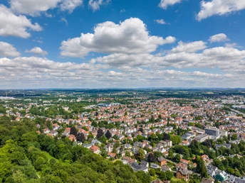
The Teutoburg Forest stretches from northwest to southeast across the entire Bielefeld city area and offers magnificent panoramic views.
Detour to the Eiserner Anton observation tower (2x 2.2km):
Hike along the ridge trail, the Hermannsweg, to the Eiserner Anton observation tower! The metal observation tower was faithfully restored in 2003. On the tower you can see the coat of arms of the County of Ravensberg and the year of construction: 1895.
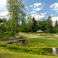
The organic urban landscape of Sennestadt was created on the southern slope of the Teutoburg Forest from 1956 according to plans by Hans Bernhard Reichow. The cycle route follows the Bullerbach from the viewing platform at the spring pond to the city pond. The Sennestadthaus stands on a peninsula in the town pond. It was originally planned as the town hall of the town, which was independent until 1973. Today, it serves as the district office and is the cultural center of the Sennestadt district.
The 42-meter-high Windelsche Wasserturm with its unusual oval ground plan is the landmark of the south of Bielefeld and can be seen from afar. It was built in 1926 and still serves as a water reservoir today.
The Windel sewage fields used to be used to trickle the waste water from the Windel textile company. Today, the Rieselfelder are an important nature reserve where many rare bird species breed and rest. Three observation towers, a barrier-free platform and signposted walking paths provide insights into the flora and fauna of the wetland biotope.
South of the Teutoburg Forest lies the Trocken-Senne. Special landforms such as inland dunes and dry valleys are typical of this part of the Senne landscape.
Hidden in a small wooded area in the Senne district of Bielefeld is the Museumshof Senne with five listed half-timbered houses dating back four centuries. The buildings were dismantled piece by piece at their original locations in the Senne and rebuilt here true to the original.
The Sennefriedhof is one of the largest and most beautiful woodland cemeteries in Germany. The transverse axis with the old chapel built in 1913, the mortuary and the water basin form a charming contrast to the pine and heathland landscape. The two gatehouses at the main entrance to the north are also worth a look.
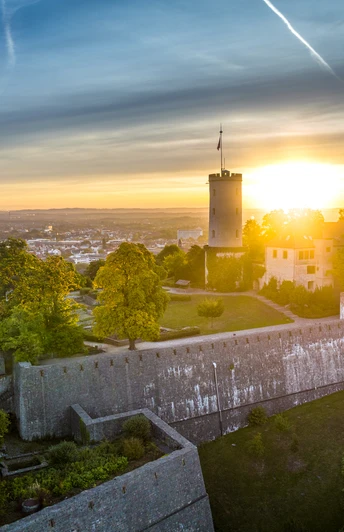
Through the Bielefelder Pass, you can drive along a car-free path with a great view of the mighty Festungsanlage Sparrenburg on the opposite mountain spur.
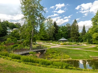
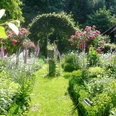
The Botanical Garden on the Kahlenberg in the Teutoburg Forest, which was created in 1912, has a unique character: its lush vegetation, winding paths, gorge with stream, rhododendrons and camellias. Admission is free.
From Johannisberg, you roll down into Bielefeld's old town. Individual stores, street cafés and green oases make up the charm of the old town. On the Alter Markt, the very rare, magnificent antler tree with its large pinnate leaves creates an almost tropical atmosphere.
Waypoints
Good to know
Pavements
Best to visit
Directions
The "Bielefelder Sihouetten Süd" cycle route is fully signposted with a route sign (white city silhouette on an orange circle)
.You can shorten or extend your tour on the "Bielefelder Sihouetten Süd" cycle route at any time, as the route runs entirely within the junction network. Signposts at the cycle route intersections (the junctions) show you the way to the next town, a nearby attraction or the train station. Large signs along the route inform you about other
Recreational cycle routes in Bielefeld
Leisure cycle routes in Bielefeld
(!) Alternative route (without route signposting):
On Lämershagener Straße, which leads from the crest of the Teutoburg Forest down to Sennestadt, there is no cycle path between junctions 76 and 74. A five kilometer longer alternative route leads through the very scenic Schopke valley to Sennestadt: From junction 77, follow the signs to junction 86 and continue in the direction of Oerlinghausen. After 3.3 km, turn right into the "Schopke" road and follow the hiking signs from the parking lot to Haus Neuland (natural path). Via junctions 15 - 18 - 17, you will return to the signposted themed route "Bielefelder Silhouetten Süd".
Tour information
Loop Road
Stop at an Inn
Directions & Parking facilities
NAVIGATION ADDRESS: Tourist Information Bielefeld
Niederwall 23
33602 Bielefeld
City rail stops Rathaus (all lines), Stieghorst (line 3) and Senne (line 1)
.Bielefeld main station, Bielefeld-Oldentrup, Sennestadt, Senne and Brackwede stations
.Always know what's running: The smart number for buses and trains in NRW 01806 504030 (20 cents/connection from landlines and a maximum of 60 cents/connection from mobile networks).
Additional information
The leaflet "Bielefeld Silouettes South" is available free of charge from the Department of Transport, August-Bebel-Straße 92, 33602 Bielefeld (in the foyer), the Bielefeld Tourist Information Office, the district offices and the ADFC Bielefeld.
Literature
The leaflet "Bielefeld Silouettes South" is available free of charge from the Department of Transport, August-Bebel-Straße 92, 33602 Bielefeld (in the foyer), the Bielefeld Tourist Information Office, the district offices and the ADFC Bielefeld.
License (master data)
Author´s Tip / Recommendation of the author
A stop at the city pond in Sennestadt is ideal for pedal boating.
The (link:) Museumshof Senne in the historic Gasthaus Buschkamp with beer garden invites you to stop for a bite to eat.
The Historical Park Johannisberg can be explored on a short detour from the information board "Am Johannisberg" (near junction 49)! "Grape tasting allowed" is the motto in the winegrower's garden on the south-eastern slope of the Johannisberg. The Bürgerterrasse offers one of the most beautiful views of the city center with the old town and Sparrenburg Castle!
Safety guidelines
South of the Teutoburg Forest, the route is mostly flat. There are longer climbs in the eastern section between Stieghorst and Sennestadt.
Some sections lead along private paths. We would like to thank the owners for their permission to use the paths.Map
The leaflet "Bielefeld Silouettes South" is available free of charge from the Department of Transport, August-Bebel-Straße 92, 33602 Bielefeld (in the foyer), the Bielefeld Tourist Information Office, the district offices and the ADFC Bielefeld.
