- 0:58 h
- 6.61 km
- 7 m
- 7 m
- 102 m
- 109 m
- 7 m
- Start: PaderHalle at Maspernplatz in Paderborn
- Destination: PaderHalle at Maspernplatz in Paderborn
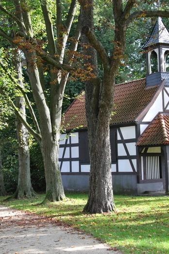
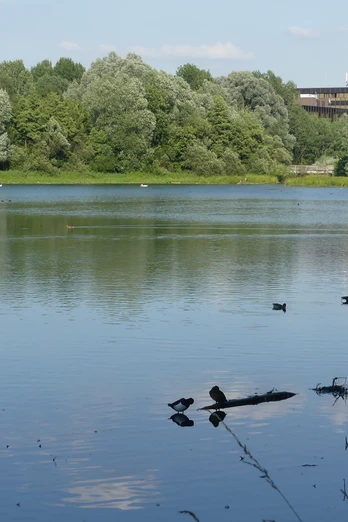
This running route runs through the most popular recreational areas close to the city center. It leads through the Pader meadows and floodplains to the Padersee lake, passes the castle and floodplain park, then runs past the small Rochus Chapel to the fish ponds. From there it heads towards Schützenplatz and back to the Paderwiesen meadows. All paths are well paved, and some are asphalted or paved.
Waypoints
Good to know
Pavements
Best to visit
Directions
From the main entrance to the PaderHalle turn left - follow the footpath along the Maspernpader - at the end turn left towards the Pader bridge - after the bridge turn right - through the Pader meadows - cross the Fürstenweg - continue on the Padersteinweg through the Paderaue - at the end turn right onto the footpath to the Padersee - follow the circular path to the left until you reach the outlet structure.
Turn left at the outlet structure before the Pader - continue on the left side of the Pader - under two road bridges - then over two smaller bridges - leave the park to the right at the round square (with flags) - cross Fürstenallee - take the footpath lined with chestnut trees - turn right at the T-junction - turn right at the asphalt path - after the two bridges, turn diagonally left onto the forest path - along the pond to the railroad tracks, then right along the railroad tracks to the path An den Fischteichen - left - over the tracks - cross Dubelohstraße - at the end of the parking lot turn right into the forest path (Franckenbergallee).
[Alternatively: take the 2 km long forest sports trail at the fish ponds (see tour of the same name)]
At the fork before the railroad tracks, take the path marked "X" - pass the tracks - turn left onto the footpath - cross the street "Fürstenallee 50-54, 56, 58" - keep left - at the traffic island take the footpath through the forest - cross Ferrari- and Löffelmannweg - at the gate of the Schützenplatz turn diagonally right into the forest path - straight ahead at the fork - at the end of the forest path continue left on Stolbergallee - through the Paderwiesen meadows to the Paderbrücke bridge/underpass - then left and back to the starting point.
Tour information
Loop Road
Stop at an Inn
Directions & Parking facilities
Parking for cars is available at Maspernplatz on the edge of Paderborn city center (navigation destination address: Heiersmauer 45, 33098 Paderborn). There are usually plenty of parking spaces there.
Tip: Buy a reasonably priced day ticket!Further information on parking options and rates: www.asp-paderborn.de.
Further information on how to get there by city bus is available at www.padersprinter.de or by telephone on 05251 6997222.
Additional information
Königsplatz 10
33098 Paderborn
Tel. 05251 8812980
tourist-info@paderborn.de
www.paderborn.de
www.facebook.com/paderborn.tourismus
www.instagram.com/paderborn.tourismus
License (master data)
