- 1:35 h
- 6.00 km
- 63 m
- 64 m
- 271 m
- 335 m
- 64 m
- Start: St. Antonius Catholic Church Bad Wünnenberg
- Destination: St. Antonius Catholic Church Bad Wünnenberg
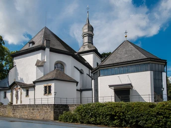
Along the 6 km circular trail, a total of 17 information boards explain interesting facts about the historically significant buildings and places of the Kneipp spa. Insights into the history are just as guaranteed as great views over Bad Wünnenberg.
Waypoints
Good to know
Pavements
Best to visit
Directions
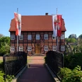
The rectory is located to the south of the church. Take the narrow path to the right past the house in the direction of "Stadtring". Diagonally opposite, another narrow alley leads to the defense tower (3).
Follow the alley past the defense tower. Before the cemetery, turn left to "Burgstraße". There, turn left again, past the "Bei Wilms" inn, directly towards the Kump (2).
Follow the short section back along "Burgstraße" until you can turn left into "Hoppenberg". The safest way to cross the road is via the crosswalk. After about 50 meters, you will see the Jewish cemetery (4) on the left-hand side. The next information point about the old city wall is located directly below the cemetery grounds (5). Between the cemetery and the residential building, a paved public path leads you to a great view below the old town wall.
After you have enjoyed the view over Bad Wünnenberg, turn right back onto the "Hoppenberg". Turn diagonally left opposite the cemetery into the street "Fernblick". After approx. 150 m, turn right into "Schöne Aussicht". Turn left again. Follow the road until you come to "Eddinghausen" on the right after approx. 600 m. A short distance (approx. 100 m) into the road, you will find the next information board about the deserted village of Eddinghausen (1a).
Back to the "Schöne Aussicht", turn right down the "Mohnberg" until you reach the hiking parking lot and the old war memorial on the Mohnberg (7).
Then head into the Aatal nature experience. Turn left at the cross. After approx. 150 m, take a sharp right and follow the footpath down the mountain over the small bridge into the Aatal. A detour via the adventure barefoot path or a visit to the wildlife enclosure is worthwhile.
If you want to continue directly with the city tour, keep left at the paddling pond. After approx. 200 m, turn left over the small bridge towards the Kurpark. After approx. 250 m you will reach the Kurpark. Once there, keep right at the small pond and you will reach the steel stele "Angel of Cultures" (8).
Pass the "Place of Silence" and continue through the spa gardens until you see the concert shell on your right. Spa concerts are held here in summer. Leave the spa park to the left of the concert shell and walk past the Aatal clinic on the left. Continue straight ahead for approx. 250 m and you will see the Immanuel Protestant Church (9) on your left.
Continue straight ahead until you reach the playground. There is a small path to the right. Follow it, cross the small bridge and then bear right again. After approx. 180 m, a narrow path leads steeply uphill to the left. At the top, turn left and follow the "Tannenweg". At the end of the road, follow the road "An der Grotte" to the right for approx. 100 m until you see the Mariengrotte (10) on the right-hand side.
Go back along the road "An der Grotte" until you take a sharp left onto "Hasselberg". Then turn right into Schäferstraße. Follow this road until you reach the bridge. Before the bridge, turn right into Mittelstraße. In "Mittelstraße", keep left until you find the next information point (12) on the left.
Then cross "Mittelstraße" carefully and turn into the crossroads behind the ice cream parlor to get to "Rosenstraße". Turn left to the St. Antonius Chapel (11).
A little further on, a small footpath on the right leads through the Naschoase to the listed Spanckenhof (16).
Walk back along the footpath and then straight ahead through "Schulstraße" until you reach the next information point about the "Unterstadt" (15).
Cross "Mittelstraße" here and continue straight ahead along "Schulstraße" until you reach "Schäferstraße". Turn right - past the site of the old Jewish synagogue and the Jewish school (13) - until you reach the main street "Leiberger Straße". On the other side of the street is the information board about the Prince-Bishop's tithe houses (14). Be careful when crossing!
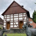
Finally, you return to the upper town. Cross the road again carefully. Between "Schäferstraße" and the main road "Heuweg", a footpath leads steeply up the Polterberg. Follow this until you reach "Burgstraße". The Historic Warehouse (6) is located diagonally to the right on the other side of the road. You will recognize it by the goat sculptures in the front garden.
To get back to the starting point, walk a little further into the "Stadtring" and take the first left into the street "Am Kirchplatz". This will take you back to the St. Antonius Catholic Church and the parking lot.
Route markings
Tour information
Cultural Interesting
Familiy-Friendly
Loop Road
Possibility of Accommodation
Stop at an Inn
Tour with Dog
Directions & Parking facilities
A33 Bielefeld/Brilon, Bad Wünnenberg-Haaren junction, then continue on the B480 towards Bad Wünnenberg. Turn left into the street "Stadtring". Then immediately turn right into "Kirchstraße".
For more information on traveling by bus, visit www.fahr-mit.de or call: 05251/2930400
Contact person
Bad Wünnenberg Touristik GmbH
License (master data)
Bad Wünnenberg Touristik GmbH
Author´s Tip / Recommendation of the author
