- 1:40 h
- 24.02 km
- 98 m
- 98 m
- 71 m
- 139 m
- 68 m
- Start: City center Enger
- Destination: City center Enger
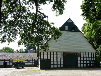
The Heuerlingsroute is an approx. 21 km long circular route that runs around the center of Enger and connects the outlying districts. The term "Heuerling" refers to the Heuerling houses or cottages in which the Heuerlings lived in poor conditions and worked for the farm owners from the Middle Ages onwards. These cottages can still be found in the countryside today.
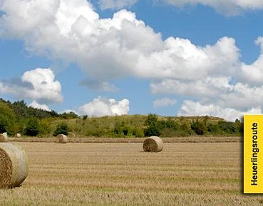
A sensible starting and finishing point for the circular route is the town center of Enger. Here, you reach the Bahn-Rad-Route via the Maiwiese meadow and can cycle along the Bolldambach stream until you reach the route at Steinbeck. From here, the route initially heads north through the sparsely populated Steinbeck and past a few farms to the small center of the farming village of Besenkamp. The route continues through fields and past hedgerows to Siele, the smallest village in the town of Enger. Here, too, the small village center is characterized by large farms. After Siele, the tour turns south again and continues through the hilly cultural landscape, dotted with small groups of trees and farms, to Dreyen and Klausheide. From here, a detour to the center of Spenge is not far away. However, the Heuerlingsroute leads further south over the Baringer Bach stream and then up to the highest point of the route at Ringsthof, one of five Sattelmeier farms still existing in Engeran. There are various explanations for the origin of the term "Sattelmeier". Possibly it stems from the fact that the owners of the farms had to provide a saddled horse in the event of war. In the archway to the large inner courtyard of the Ringsthof, there is a coat of arms with a saddled and bridled horse on the shield. The Sattelmeier farms are probably the oldest farms in the region and today are among the largest farms in the Ravensberg region. The Heuerlingsroute continues through Pödinghausen and Oldinghausen, past two more impressive Sattelmeier farms. The last place on the circular route is Herringhausen-Dorf before reaching the starting point at Bolldammbach near Steinbeck.The route focuses on experiencing the historic cultural landscape with its cottages, farms, villages, fields, hedgerows and forests. Those who cycle the Heuerlingsroute focus on the essentials, namely cycling and the scenic experience. The hills of the Ravensberger Land provide ever-changing views of the landscape, but also require a certain level of fitness to cope with the recurring climbs. The route has very little traffic and runs almost exclusively along quiet, asphalted side roads. This makes the route ideal for groups or families, as well as racing bikes.
Further information on the route and the waypoints can be found on the homepage of the town of Enger or the cycle leisure homepage of the district of Herford: www.fahr-im-kreis.de.Waypoints
Good to know
Pavements
Best to visit
Directions
Tour information
Familiy-Friendly
Loop Road
Directions & Parking facilities
Additional information
License (master data)
Author´s Tip / Recommendation of the author
Sights along the route:
- historic cottages
- old estates
- attractive views of the cultural landscape
Refreshment stops:
- "Brünger in der Wörde" with beer garden, Enger
- "Alter Dorfkrug", Enger
- "Nölkenhöners Hof" with summer terrace, Enger
- "Zum weißen Stein" restaurant-pizzeria with beer garden, Enger
Further information on the route and the waypoints can be found on the cycle leisure website of the district of Herford: http://www.fahr-im-kreis-herford.de/alle-touren/themenrouten/heuerlingsroute
Safety guidelines
1. cycling on the cycle routes is at your own risk, everyone is responsible for themselves.
2.
2. the road traffic regulations apply to all cyclists
.3. a roadworthy bicycle must be used for the cycle tours.
4. The wearing of a bicycle helmet is recommended.


