Spökenkieker-Route


- 3:00 h
- 39.58 km
- 54 m
- 54 m
- 54 m
- 74 m
- 20 m
- Start: Start possible in Harsewinkel, Marienfeld or Greffen

Stadt Harsewinkel

Stadt Harsewinkel
Harsewinkel-Logo mit modernen Quadraten und Slogan "Die Mähdrescherstadt", symbolisiert Innovation.
Waypoints
Start
Good to know
Best to visit
suitable
Depends on weather
Directions
Start in Harsewinkel:
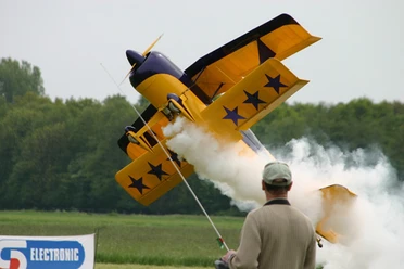
Leave the town center on the right at the town hall and head towards the Südring/Münsterstraße junction. Cross the junction and take the cycle path on the right into Mühlenwinkel. Follow Mühlenwinkel for about 1 km, then turn left into Tüllheide. Follow the road for approx. 1.2 km, cross the Ems and then turn right into Kuhstraße at Ikarus Modellflugplatz. Follow the road, after approx. 800 m follow the slight left-hand bend and then turn right into Kortenhegge. Follow the road, cross Heerdamm, onto Körkesweg and follow the road straight ahead for approx. 2.5 km. Then turn right onto Haarweg. Follow Haarweg for approx. 500 m. At Beelener Straße, turn right onto the cycle path on the left-hand side of Beelener Straße. Here it is worth visiting the Motorcycle and Doll Museum Beckmann. Follow Beelener Straße for approx. 1 km. Then turn right into the housing estate onto Römerweg and immediately left again onto Kolpingstraße. Follow Kolpingstraße for approx. 500 m.
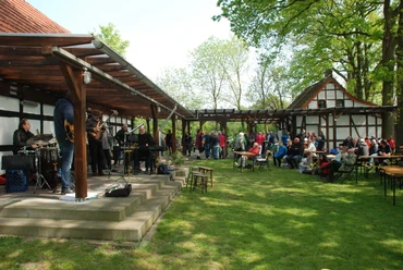
Start in Greffen: Cross the main road and take Ostortstraße. Follow Ostortstraße for approx. 1.3 km. Then turn left into Fasanenstraße. Follow Fasanenstraße for approx. 1 km. Then turn right into Niedickstraße. Follow Niedickstraße for approx. 2 km. Then turn right onto Tecklenburger Weg. Cross Haller Straße after 400 m and continue on Tecklenburger Weg. After 500 m, continue straight ahead onto Berkendiek. Follow the road for approx. 1.5 km. Then turn left onto Oesterwegerstraße. Follow the road for 500 m. (Here it is worth taking a short detour to the Farmhouse Jazzclub. Simply follow Oesterwegerstraße straight ahead for 1 km, turn left onto Vorbruchstraße and turn left onto the jazz club). Then turn right onto Greffener Landweg. Follow the road for approx. 4 km, cross Hesselteicher Straße and follow Greffener Landweg for another kilometer. Then turn right onto An der Egge. Follow the road for approx. 3 km. Then turn right onto Steinhäger Straße. Follow Steinhägerstraße for approx. 500 m (please drive carefully at this point), then turn left onto Prüske Egge. Follow the road for approx. 2 km. Then turn right onto Prüske Egge. Follow the road for approx. 300 m. Then turn right onto Pagenkamp. Follow the road for approx. 3 km. Then turn right onto the cycle path on the left-hand side of Brockhägerstraße. Follow the road for approx. 300 m. Then turn left onto Auf den Middeln and after 200 m turn left onto Wadenhardstraße. Follow the road for approx. 1.5 km. At the crossroads, turn right into Bussemasstraße. Follow the road for approx. 600 m. Continue straight ahead into Möllenbrocksweg. Follow the road for approx. 400 m. Then turn left into Adenauerstraße. Follow the road for approx. 1 km to the end. Then turn right onto Bielefelder Straße. Follow the road for approx. 100 m. (The former Marienfeld Monastery is located on the right-hand side of the road approx. 100 m further on).
Start in Marienfeld: Then turn right onto the cycle path on the right-hand side of Bielefelder Straße. Follow Bielefelder Straße for about 800 m. At the junction, continue straight on into Heckerheide. Follow Heckerheide for approx. 1.5 km. Then turn right into Heckerheide. Follow the road for 3 km through the Boomberge nature reserve. Then turn right before the main road into a small side road. Immediately turn left again and then right at the main road onto the cycle path on the left. Follow the road for 100 m, cross the Lutter and continue left onto Diepenbrocksweg. Follow the path for 250 m. Then turn left onto Südring. Follow the road for 250 m. Turn right at the crossroads into Münsterstraße. Then you have reached the starting point in Harsewinkel again.
Leave the town center on the right at the town hall and head towards the Südring/Münsterstraße junction. Cross the junction and take the cycle path on the right into Mühlenwinkel. Follow Mühlenwinkel for about 1 km, then turn left into Tüllheide. Follow the road for approx. 1.2 km, cross the Ems and then turn right into Kuhstraße at Ikarus Modellflugplatz. Follow the road, after approx. 800 m follow the slight left-hand bend and then turn right into Kortenhegge. Follow the road, cross Heerdamm, onto Körkesweg and follow the road straight ahead for approx. 2.5 km. Then turn right onto Haarweg. Follow Haarweg for approx. 500 m. At Beelener Straße, turn right onto the cycle path on the left-hand side of Beelener Straße. Here it is worth visiting the Motorcycle and Doll Museum Beckmann. Follow Beelener Straße for approx. 1 km. Then turn right into the housing estate onto Römerweg and immediately left again onto Kolpingstraße. Follow Kolpingstraße for approx. 500 m.
Start in Greffen: Cross the main road and take Ostortstraße. Follow Ostortstraße for approx. 1.3 km. Then turn left into Fasanenstraße. Follow Fasanenstraße for approx. 1 km. Then turn right into Niedickstraße. Follow Niedickstraße for approx. 2 km. Then turn right onto Tecklenburger Weg. Cross Haller Straße after 400 m and continue on Tecklenburger Weg. After 500 m, continue straight ahead onto Berkendiek. Follow the road for approx. 1.5 km. Then turn left onto Oesterwegerstraße. Follow the road for 500 m. (Here it is worth taking a short detour to the Farmhouse Jazzclub. Simply follow Oesterwegerstraße straight ahead for 1 km, turn left onto Vorbruchstraße and turn left onto the jazz club). Then turn right onto Greffener Landweg. Follow the road for approx. 4 km, cross Hesselteicher Straße and follow Greffener Landweg for another kilometer. Then turn right onto An der Egge. Follow the road for approx. 3 km. Then turn right onto Steinhäger Straße. Follow Steinhägerstraße for approx. 500 m (please drive carefully at this point), then turn left onto Prüske Egge. Follow the road for approx. 2 km. Then turn right onto Prüske Egge. Follow the road for approx. 300 m. Then turn right onto Pagenkamp. Follow the road for approx. 3 km. Then turn right onto the cycle path on the left-hand side of Brockhägerstraße. Follow the road for approx. 300 m. Then turn left onto Auf den Middeln and after 200 m turn left onto Wadenhardstraße. Follow the road for approx. 1.5 km. At the crossroads, turn right into Bussemasstraße. Follow the road for approx. 600 m. Continue straight ahead into Möllenbrocksweg. Follow the road for approx. 400 m. Then turn left into Adenauerstraße. Follow the road for approx. 1 km to the end. Then turn right onto Bielefelder Straße. Follow the road for approx. 100 m. (The former Marienfeld Monastery is located on the right-hand side of the road approx. 100 m further on).
Start in Marienfeld: Then turn right onto the cycle path on the right-hand side of Bielefelder Straße. Follow Bielefelder Straße for about 800 m. At the junction, continue straight on into Heckerheide. Follow Heckerheide for approx. 1.5 km. Then turn right into Heckerheide. Follow the road for 3 km through the Boomberge nature reserve. Then turn right before the main road into a small side road. Immediately turn left again and then right at the main road onto the cycle path on the left. Follow the road for 100 m, cross the Lutter and continue left onto Diepenbrocksweg. Follow the path for 250 m. Then turn left onto Südring. Follow the road for 250 m. Turn right at the crossroads into Münsterstraße. Then you have reached the starting point in Harsewinkel again.
Tour information
Familiy-Friendly
Loop Road
Stop at an Inn
License (master data)
Markus Wiegert

Map
The route of the Spökenkiekerroute is shown on the town map of Harsewinkel. The map is available free of charge from the Harsewinkel town office (Tel.: 05247 935200; e-mail: info@harsewinkel.de).
Download GPX file
Photo Gallery


