Sennebahn-Wanderweg


- 3:06 h
- 12.87 km
- 18 m
- 11 m
- 98 m
- 116 m
- 18 m
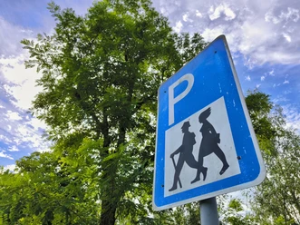
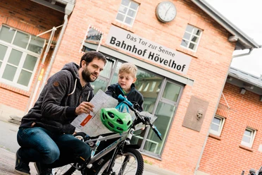
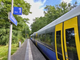
- Start: Hövelhof station - the gateway to the Senne
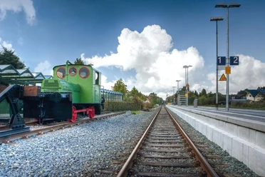
- Destination: Hövelhriege stop
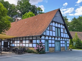
A nature lover's heart beats faster in Hövelhof, at the foot of the Teutoburg Forest and at the source of the River Ems. At the same time, Hövelhof is a modern business location with healthy medium-sized companies. Until 1900, conditions in the rural community were still very poor in places. It was not until the rail connection to the "Sennebahn" - the line between Paderborn and Bielefeld - in 1902 that a strong economic upturn began. Today, Hövelhof stands for an ideal combination of industry and tourism, which is particularly noticeable on the Sennebahn hiking trail.
The starting point is Hövelhof railroad station as the "gateway to the Senne". The trail is also particularly suitable for families with children, as the destination is the "second Hövelhof station", the stop in Hövelriege. This means you can make the return journey more relaxed and introduce the little ones to train travel in an interesting way.


Waypoints
Good to know
Pavements
Best to visit
Directions
Start at Hövelhof station - head north towards Westfalenstraße - turn left into Westfalenstraße and then immediately right into Hochstiftstraße. After about 400 m, turn left into Sporckstraße - the road turns into a small pad, follow this until it crosses Bielefelder Straße (L756). Next, cross the road and turn slightly left into Schillerstraße. At the next opportunity, turn right into Gutenbergstraße. At the end of the street, turn left onto Gehastraße. At the "Geha-Werke", turn left at the fork onto Gütersloher Straße - after approx. 200m, cross the road and turn into Nordstraße. At the end of the road, keep slightly to the right and after another 50m turn left into "Alkenbrink". From here, follow "Alkenbrink" for a long way to the end (approx. 1.8 km) - then turn right into Hallerweg. Hallerweg ends at Gütersloher Straße (L757) - cross it carefully and enter the forest (recognizable by the tree trunk). From here, follow the signs in the forest until you reach a gravel path at the end of the forest path at the Ems. Turn left onto the gravel path (Junkernallee) - behind the newly built bridge there are benches at the millstones where you can take a break. The Junkernallee leads out of the forest after about 1 km and then continues into the center of Riege, past the village school museum and the Riege church. At the end of the road, at the small food market, cross Detmolder Straße and take Furlweg. From here, the path leads directly to the small Furlmühle mill. From there, follow the signs to Rixelweg - turn right at the railroad tracks into Kattenheider Weg. Follow this and you will be led into the "Rixelbruch" nature reserve - at the end, turn left onto the asphalt road, Nachtigallenweg, and then immediately right again onto Falkenweg - from here, continue straight on to the Hövelriege stop, the end of the hike
Tour information
Familiy-Friendly
Loop Road
Stop at an Inn
Equipment
Directions & Parking facilities
On the A33 from Paderborn take exit 24 Paderborn-Sennelager and turn right towards Hövelhof. In Hövelhof, turn right at the main intersection in the town center. Shortly before the railroad tracks, turn left into Bahnhofstraße. The train station is on the right-hand side.
From the direction of Bielefeld, leave the A33 at exit 23 Stukenbrock-Senne and turn left towards Hövelhof. Drive straight on through the traffic circle and turn left at the main intersection in the town center. Shortly before the railroad tracks, turn left again into Bahnhofstraße. The train station is on the right-hand side.
Take bus line H11 from Paderborn, get off at Bahnhof.
Nahverkehrsverbund Paderborn/Höxter
Always know what's running: The smart number for buses and trains in NRW 01803 504030 (timetable information for €0.09/min from a German landline, mobile max. €0.42/min)
Additional information
Further information:
Tourist Information Hövelhof
Schloßstraße 11
33161 Hövelhof
Tel: 05257 5009-860
Fax: 05257 5009-869
tourismus@hoevelhof.de
Documents
License (master data)
Helena Kottowski

Author´s Tip / Recommendation of the author
Visits to the village school museum or the historic Furlmühle mill
.Note: Please register with the respective contact person before the hike!
Village School Museum Riege:
Pre-registration for the tour and historical school lesson
Contact person: Ferdinand Stöppel, Tel.: 05257 9380174
Furlmühle Riege:
Pre-registration for guided tour and visit
Contact person: Thomas Wecker, Tel.: 05257 5752
Safety guidelines
Pay particular attention when crossing the roads.
These are sometimes busy roads without pedestrian lights!
Social Media
Download GPX file
Photo Gallery


