Radtour DE 8- Bentfeld


- 1:37 h
- 15.76 km
- 53 m
- 53 m
- 88 m
- 110 m
- 22 m
- Start: Bentfeld church
Explore the district of Bentfeld and its surroundings on this 15-kilometre tour, which is suitable for families with children. The village is located south-east of Delbrück and borders directly on the district town of Paderborn.
The name Bentfeld was first mentioned in a document from 1082, but traces of Stone Age gatherers and hunters suggest that Bentfeld was settled earlier. Archaeologists date a stag horn harpoon found in 1992 to between 6,500 and 5,000 BC.
The district of Bentfeld is characterized by numerous quarry ponds, which were created after the Second World War by sand and gravel mining along the Lippe. The excavation of these deposits has fundamentally changed the landscape in the Lippe lowlands. Following the gravel extraction, the artificial lakes that were created are predominantly subject to landscape protection and are not used for recreational purposes.Start your circular route at the church in Bentfeld. The church of St. Dionysius, centrally located in the village, is a branch church of the Catholic parish of St. Landolinus Boke. The first mention of a chapel in Bentfeld dates from 1650 to 1661, as evidenced by a bell from 1655, which is now in the cemetery chapel.Drive along Bentfelder Straße into Gunneweg, where the Gunnewiesen are located. The wet meadows and the nature reserve are of great importance for meadow birds, animals and plants of the open landscape and wetlands. They are partly owned by the state of NRW. Optimization measures are carried out through voluntary protection in the form of pollarded willow maintenance and newly created ponds (shallow ponds).
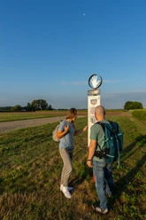
In the north of Bentfeld, the cycle path leads past numerous quarry ponds. A total of around 50 excavations of the significant gravel and sand deposits in the entire Lippe lowlands have fundamentally changed the landscape along the Lippe. Animals and plants that are tied to the water, such as great crested grebes, ducks and swans, have conquered a new habitat in recent years.The route continues towards Scharmede via Sandhöfener Straße, Im Großen Winkel, Eschenfeld, Zum Rottberg and Holzweg. The route leads past Scharmede into the nature reserve between Bentfeld and Thüle. Here, benches and meadows along the way invite you to take a short breather and enjoy the beauty of nature in the Delbrücker Land region.Follow the signposts to reach the Roman camp with information stand. Continue via Schafbreite and Lippeweg back to the starting point of the tour. In the center of Bentfeld, the restaurants invite you to linger.


Waypoints
Good to know
Pavements
Best to visit
Directions
Tour information
Familiy-Friendly
Loop Road
Stop at an Inn
Directions & Parking facilities
Always know what's running: The smart number for buses and trains in NRW 01803 504030 (timetable information for €0.09/min from a German landline, mobile max. €0.42/min).
Additional information
Literature
License (master data)
Ricarda Steiling

Author´s Tip / Recommendation of the author
Safety guidelines
Map
Download GPX file
Photo Gallery


