Radtour DE 7- Anreppen


- 1:15 h
- 16.09 km
- 36 m
- 36 m
- 84 m
- 93 m
- 9 m
- Start: Anreppen church
The DE 7 circular trail takes you through the Roman village of Anreppen and its surroundings. It is particularly suitable for families with children, as the difference between the highest and lowest points is only 15 meters and is also mostly suitable for skaters. The first documented mention of Leste, which is now part of Anreppen, dates back to 1031. Anreppen itself was first mentioned in 1250.
Start your tour at the church and explore the district of Anreppen and its surroundings from here for around 17 kilometers. The Koldenhof, one of the oldest documented farmsteads in the Delbrücker Land region, is well worth a visit.
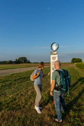
The St. Josef Church in Anreppen is a branch church of the St. Landolinus Church in Boker and was completed in 1949. After an interior renovation in 1994, the building finally received its church tower in 1996, which was consecrated in 1997. In the immediate vicinity of the church are the old teacher's house, the kindergarten and the Anreppen community hall. From here, the route leads along Anreppener Straße, via Auf dem Teich and Klosterweg to Waldweg. Here you will find some lake landscapes between the Waldweg and Graf-Meerveldt-Straße.Continue along Graf-Meerveldt-Straße, Heddinghauser Straße, Lippeweg and Schafbreite. There are several quarry ponds along this section of the route. Via the Am Römerlager road, you will reach the Roman camp with its information stand.
The discovery of Augustan shards led to the discovery of a Roman legionary camp in 1967 and brought it national fame. It was located directly on the River Lippe in what is now Anreppen and extensive archaeological excavations have since shown that the military site was 23 hectares in size and had room for an entire legion (approx. 6,000 men) including auxiliary troops. The traces of huge fortifications and buildings of imposing dimensions are proof of the strategic importance of the Lippe site. The camp was used by the Romans in the first decade after the birth of Christ.Enjoy the extensive meadow landscape along the Lippe as you continue along the route. Follow the signposts and cross the Diebeskämpen to reach the biotope area on the Hengsterberg. Take a short break and enjoy nature during a picnic along the way.You return to the church, the starting point of the tour, via Lütkenheide and along Anreppener Straße. Along this circular route, the restaurants along the way also invite you to take a short or longer breather.


Waypoints
Good to know
Pavements
Best to visit
Directions
Tour information
Familiy-Friendly
Loop Road
Stop at an Inn
Directions & Parking facilities
Always know what's running: The smart number for buses and trains in NRW 01803 504030 (timetable information for €0.09/min from a German landline, mobile max. €0.42/min).
Additional information
Literature
License (master data)
Ricarda Steiling

Author´s Tip / Recommendation of the author
Safety guidelines
Map
Download GPX file
Photo Gallery


