Haller Spuren | Rundwanderweg in Halle (Westf.)


- 1:40 h
- 5.39 km
- 190 m
- 190 m
- 136 m
- 222 m
- 86 m
- Start: Hikers' parking lot Drachenwiese, Grüner Weg, 33790 Halle (Westf.)
- Destination: Hikers' parking lot Drachenwiese, Grüner Weg, 33790 Halle (Westf.)
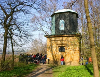
The trail runs for around 1.5 km along the "Forest Burials History Trail". You will pass the Steinbuch, which is a nature reserve, and after a short climb, enjoy a fantastic view of the so-called "Ascheloher Schweiz". The "Kaffeemühle" viewpoint awaits towards the end of the tour.


Waypoints
Good to know
Pavements
Best to visit
Directions
Tour information
Loop Road
Mainly Shady
Premium Trail "Wanderbares Deutschland"
Equipment
Directions & Parking facilities
Always know what's running: The smart number for buses and trains in NRW: 01806 504030 (20 cents/connection from landlines and a maximum of 60 cents/connection from mobile networks).
Train station / ZOB 1.5 km from the start and finish points
Additional information
License (master data)
Stadt Halle

Author´s Tip / Recommendation of the author
Safety guidelines
Download GPX file
Photo Gallery


