- 3:30 h
- 41.79 km
- 168 m
- 171 m
- 127 m
- 235 m
- 108 m
- Start: ADFC Station Bad Meinberg
- Destination: Historic small town of Nieheim with Culinarium
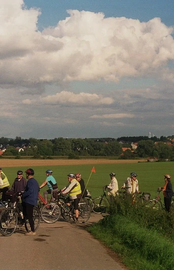
Cozy and mostly flat loop through the rural Hochstift to the historic small town of Nieheim, enjoy the specialties there.
Waypoints
Start
Destination
Good to know
Best to visit
suitable
Depends on weather
Directions
We start at the ADFC station, follow "Parkstraße" through the park, turn left into "Pyrmonter Straße", after 20 m turn right into "Seestraße". At the pedestrian lights, we cross the B 239 and follow "Vahlhausener Straße", from the next junction on the new citizens' cycle path (left side of the road) with the "Fürsten-Radroute" in the direction of "Freibad" and come to the junction with the "L823", There we turn left onto the citizens' cycle path - crossing the road once on the "L823" - until we reach the field path signposted "Ottenhausen", turn right there and reach the small apple tree avenue at -km 5.6- the village of Ottenhausen.
Follow "Rehbergstraße" until it joins the main road, turn right into "Langestraße", continue straight on "Am Anger" out of the village and turn left onto the second paved field path. This leads us past an orchard to a large wooden field cross at the "Hilgenstock" on a small hill and we reach the L 827. Here we keep left, ride along the busy road for approx. 250 m and turn right onto the asphalt path. We descend a gentle slope to the large "Hofgut Vordereichholz" estate - km 10.0 -
After crossing the Heubach stream, we turn right onto the asphalt path, which leads us through the fields to a Catholic wayside cross from 1887 with two striking trees. Here we keep left, the "Prozessionsweg" leads us past the outskirts of Bergheim, at the end of which we turn left onto "Mittlere Straße" and cross under the railroad line. After 50 m, turn right into "Koobenweg", this asphalt farm track leads us through undulating farmland. At the next crossroads, we turn right, which leads us to Oeynhausen. At the edge of the village, we keep left onto the path "Zur Tweete" and reach the Emmerbrücke bridge. - km 14.7-.
Just after the bridge, we turn left onto the asphalt path, the agricultural road now winds its way through the fertile Emmer floodplains with their impressive pollarded willows.
Attention: approx. 300 m after the second farm, we turn right up the hill. We can also push the bike for the short, steeper section, but once we reach the top, we go straight on, downhill - "Am Brodberg" - and reach the "L755". We turn left onto the cycle-pedestrian path and enter the town of Nieheim on "Hospitalstraße". We continue straight ahead, the "Marktstraße" leads us to the Kumpbrunnen at the "Gasthaus Müller" or further straight ahead to the town hall.
The NRW cycle path signs lead us from the town hall down the "Wasserstraße" and follow it to the edge of the town. There, turn right at the clear junction into "Sägemühlenweg" and reach the "Europa-Radweg R1" or "D 3-Netz". Keep left here and follow the "R53" signs towards Steinheim. The markings lead us through the fields into the Emmer floodplain and along the banks of the river to Steinheim. After crossing the Emmer, we follow the "Höxterstraße" to the market square of this lively little town. -KM 29.0-
Our last stage takes us back on "Höxterstraße" out of town until we reach our cycle path again, we turn left before the Emmer bridge and now follow the NRW cycle path signs "Wöbbel + R 53" through the quiet residential streets. Later, we cycle through the Emmer meadows, cross under the railroad line and soon reach the entrance to Wöbbel. Here we meet up with the "Fürsten-Radroute" again, we turn left in the direction of travel over the K 73 into the farm track with the NRW cycle path signposting "Horn". In the following section, the surface changes several times between asphalt and gravel, crosses under the Ostwestfalenstraße and turns right immediately after the underpass, at the end of the gravel surface we come to an asphalt field path, where we follow the "Fürsten-Radroute" to the left. On the outskirts of Billerbeck, turn right. Follow the K 77 to the "Beller Holz" forest area, turn left onto the "Entenkrugweg" - initially tarred, later 100 m natural path - and reach the village of "Entenkrug". Here we keep left in the direction of "Bad Meinberg", the asphalted forest path leads us slightly uphill after a short, steep incline. We cross under the B 239 and follow the cycle path uphill. The highest point is already reached at Kohlenberg, past the "Schauinsland" hotel, down to the traffic lights, straight ahead here and after 40 km we have reached the starting point in Bad Meinberg again.
Tour information
Familiy-Friendly
Loop Road
Stop at an Inn
Equipment
at least a city bike with 7-speed gears
Directions & Parking facilities
B 1 + 239 Bad Meinberg > Spa area NORD
Public parking lot Brunnen- / Hamelner Straße
Bad Meinberg bus station
Additional information
www.adfc-lippe.de / www.havergoh.de
Literature
Sabine Schierholz "Der Naturpark Teutoburger Wald Eggegebirge" , TPK-Regionalverlag, ISBN 978-3-936359-34-3
License (master data)
Safety guidelines
Medium length, somewhat longer climbs, stamina required.
Map
BVA Cycling in Lippe ISBN 978-387073-048-2


