- 1:30 h
- 5.80 km
- 7 m
- 8 m
- 119 m
- 126 m
- 7 m
- Start: Parish church of St. Joseph in Paderborn-Marienloh
- Destination: Parish Church of St. Joseph
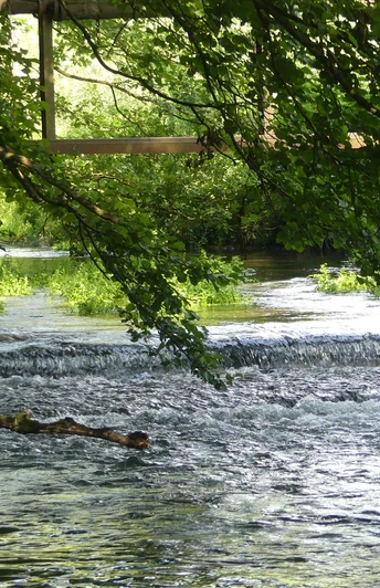
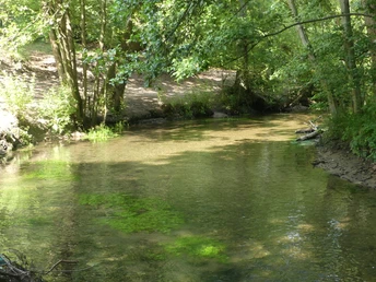
The "Marienloher Lipperundweg" trail is just under six kilometers long and leads through the floodplain areas of the Lippe to the north of the village. Paddocks and hay meadows lie on both sides of the path in the first part of the hike, which is lined with numerous old pollard willows, ash trees, oaks and poplars. Since 1992, a large boulder has marked the point where the Beke, which has traveled around 17 kilometers to get here, flows into the Lippe. It is a little noisier near the B 1. This is followed by a beautiful nature trail that runs alongside the Lippe through the forest. It continues along a sandy path for nature conservation reasons, then along Prederkoppeln paddocks back to the starting point.
The hike has no significant differences in altitude. However, sturdy footwear is advisable due to the natural paths.
Good to know
Pavements
Best to visit
Directions
The starting point of this walk is the parish church of St. Joseph in Marienloh. We walk along Bendeslo street in the direction of the savings bank branch. There we turn right into Sommerbrede. There are several parking spaces on the right-hand side. We walk straight on towards the forest. There is a kindergarten on the right and Marienloh elementary school on the left.
At the end of Sommerbrede, we walk into the forest. We ignore the first forest path branching off to the right. We turn right onto the second, which begins at crossroads station 8. Straight ahead we see the Schützenplatz. We pass four more Stations of the Cross before the path meets a tarmac path, the Senneweg, at the end of the forest. We continue along this path to the left. On the right, we now see a white fence, behind which is an impressive half-timbered building, the so-called "Schloss", built around 1760.
The forest ends on the left; we cross a small stream on a bridge and continue straight ahead. After passing the property of a riding stable, we see the sign "Naturschutzgebiet Lippeniederung zwischen Bad Lippspringe und Mastbruch" on the right and pass an underpass of the former Paderborn-Bad Lippspringe railroad line (now a cycle path).
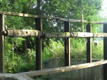
150 meters further on, we reach a fork in the path where there is a board with information about the nature reserve. We take the left-hand path. Mighty old trees - ash, oak, poplar and willow - accompany us on the following section. The asphalt ends and we continue on a narrower gravel path. It meets an asphalt path, which we follow to the left. We also take the left alternative at the next fork. Just before the houses, immediately after crossing a small stream, we turn right onto the gravel path. A good 100 meters further on, we walk towards a bridge over the Beke, but keep right before it and walk along the Beke on a gravel path for about 150 meters. At a large boulder with the year 1992, we come across another bridge; it is a concrete bridge with metal railings that spans the Lippe. On the left, we see the mouth of the Beke into the Lippe.
Stage 2: Beke-Lippe confluence - church: 3.2 km
We cross the Lippe bridge, turn right and shortly afterwards pass a second concrete bridge with metal railings. Immediately to the right, we see the remains of a weir. We now have a small climb up to an ice-age sand dune. At the top, we keep slightly to the right. After the equally short descent, we turn left at the fork and walk along the chippings path towards the main road ("B 1 neu"), which we can recognize by the noise of the cars. We pass the pedestrian bridge completed in 2024 and continue straight ahead on the narrow path. Shortly afterwards, we come to a point where four paths meet. We choose the first one on the right. This is the path that is also marked with the hiking trail sign "X" (X4: Diemel-Lippe-Weg).
After about 350 meters we reach the Lippe and continue our hike to the left along the bank. Shortly afterwards, we pass a huge sand dune. This is a popular swimming spot for children in warm weather because of its "sandy beach". Around 80 meters after this, we reach a bridge where both our path and the Lippe cross under the "B 1 neu" road.
After the bridge, we turn left, as the path further along the steep bank of the Lippe should not be walked on for nature conservation reasons and therefore may not be marked as a hiking trail. We walk along the busy Bundesstraße 1 for about 50 meters. We then turn right and walk along the wide sandy path/riding trail (Neuhäuser Weg) for around 700 meters until we reach a small parking lot. There we turn right and follow the asphalt path. Soon after, we cross the double-arched Lippe bridge. A good 200 meters further on, we reach the familiar fork in the path with the information board, where we keep left. After passing the underpass, we see the riding stables again on the right and the area of the "castle" surrounded by a white fence on the left. Where the white fence ends, we turn right into the narrow forest path and follow the path along the Stations of the Cross. At the end of the path, at Way of the Cross station 8, we turn left and soon reach the edge of the forest. From there, it is about 300 meters to our starting point, the church.
Tour information
Familiy-Friendly
Loop Road
Equipment
Directions & Parking facilities
The city bus line 2 (PaderSprinter) runs between Paderborn and Marienloh, the destination stop is "Marienloh Mitte".
For more information on how to get there by city bus, visit www.padersprinter.de or call 05251 6997222.
Additional information
Königsplatz 10
33098 Paderborn
Tel. 05251 8812980
www.paderborn.de
www.facebook.com/paderborn.tourismus
www.instagram.com/paderborn.tourismus
Literature
Pocketbook "The most beautiful half-day hikes in the Paderborn region and Eggegebirge" with 20 interesting circular tours through the local region (220 pages). Available for 12.95 euros from Paderborn Tourist Information, bookshops (ISBN: 978-3-9809507-8-7) and - free of charge - from HEFT-Zeitschriftenverlag (Tel. 05251 62624).
License (master data)
Author´s Tip / Recommendation of the author
Safety guidelines
Two notes:
1. A large part of the route is located in the nature reserve "Lippeniederung zwischen Bad Lippspringe und Mastbruch". Dogs must be kept on a lead there.
2 For nature conservation reasons, the marked hiking trail partly leaves the direct steep bank of the Lippe and runs a few meters offset on a wide sandy path directly along the border of the military training area. Please follow this path to protect the flora and fauna, even if some people do not. Thank you very much!
Social Media


