- 2:00 h
- 8.00 km
- 56 m
- 56 m
- 316 m
- 368 m
- 52 m
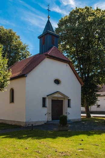
- Start: St. Sturmius Chapel, Bad Wünnenberg-Elisenhof
- Destination: St. Sturmius Chapel, Bad Wünnenberg-Elisenhof
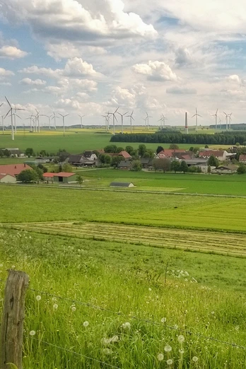
With just under 120 inhabitants, Elisenhof is the smallest district of Bad Wünnenberg. Starting at the St. Sturmius chapel, you continue through the Friedrichsgrund up to the settlement of Eilern. Passing the Mittelborn spring, which was of great importance for the water supply of Elisenhof for a long time, you walk through a small wooded area towards the old gallows square. The last execution took place at this "execution site of the Sintfeld" in 1786. A memorial stone commemorates the history. Over the Eilerberg, with a great view of Elisenhof, you return to the starting point.
Good to know
Pavements
Asphalt
Gravel
Trail
Best to visit
suitable
Depends on weather
Directions
The tour starts at the St. Sturmius Chapel in Elisenhof.
Route markings
Green license plate with red corner.
Tour information
Labelling
Loop Road
Suitable for Winter
Tour with Dog
Equipment
Sturdy shoes and some provisions are recommended.
Directions & Parking facilities
A44 Dortmund-Kassel, exit Meerhof. Follow "Dahlheimer Straße", then turn right into "Heubusch" - to Elisenhof.
A33 Bielefeld/Brilon, junction Bad Wünnenberg-Haaren, take the exit and follow the A44 towards Kassel. Take the Meerhof exit. Follow Dahlheimer Straße, then turn right into "Heubusch" - to Elisenhof.
A33 Bielefeld/Brilon, junction Bad Wünnenberg-Haaren, take the exit and follow the A44 towards Kassel. Take the Meerhof exit. Follow Dahlheimer Straße, then turn right into "Heubusch" - to Elisenhof.
There is free parking around the St. Sturmius Chapel.
For information on traveling by bus, please visit www.fahr-mit.de or call: 05251/2930400
Contact person
Bad Wünnenberg Touristik GmbH
Im Aatal 1
33181 Bad Wünnenberg
License (master data)
Bad Wünnenberg Touristik GmbH
Author´s Tip / Recommendation of the author
Pay a visit to the "Meiwes" farm in Elisenhof. You can buy great regional food here. We particularly recommend a visit during strawberry season.


