Auen-Radweg


- 3:30 h
- 44.55 km
- 248 m
- 248 m
- 208 m
- 456 m
- 248 m
- Start: Jesuit Church Büren
- Destination: Büren
The Bürener Land region is very diverse in terms of landscape and extremely interesting in terms of cultural history. It is criss-crossed by many hiking trails, but it is often too mountainous for cyclists. This gave rise to the idea of creating a circular cycle route that even less trained cyclists could complete in one day and that is largely free of inclines.
The 44 km Auenradweg meets these requirements. It leads along the Alme, Nette, Lühlingsbach, Aabach and Afte rivers through one of the most scenic regions of the Bürener Land.
The route along the floodplains offers rare flora and fauna typical of floodplains as well as natural history and cultural history stations on the subject of water:
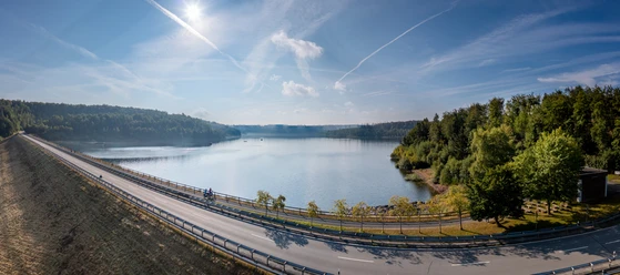
- The Aabach dam as the region's drinking water reservoir
- Kneipp facilities in the Naturerlebnis-Aatal
- Water birds at the Keddinghauser See retention basin
- Historical water mills in Büren
- Amphibian and fish nature trails
- Flösswiesen
- and limestone alluvial cones.
Except for short sections near Bleiwäsche, there are hardly any inclines along the route.

Good to know
Pavements
- Street (4%)Asphalt (25%)Gravel (59%)Trail (5%)Path (7%)
Best to visit
- suitableDepends on weather
Directions
- From the Jesuitenkirche in Büren, follow the route through the Aftetal valley towards Hegensdorf/Keddinghausen, past the Keddinghäuser See lake. Continue along the Aftetal valley to Bad Wünnenberg. Go straight on at the traffic lights and then turn right into the road "Im Aatal". Follow this road with a short ascent to the Aabach dam. After approx. 2 km, turn off in an anti-clockwise direction towards Bad Wünnenberg-Bleiwäsche. This is the last climb on the circuit.
After you have crossed the village, the route goes downhill past the Lühlingsbach and the Nette into the Almetal valley. Here you continue to follow the signs through Ringelstein, Siddinghausen and Weine until you reach your starting point in Büren again. Route markings
- Follow the blue logo of the Auen cycle path.
Tour information
Loop Road
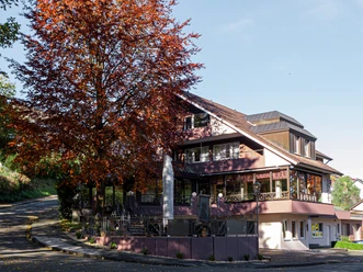
Possibility of Accommodation
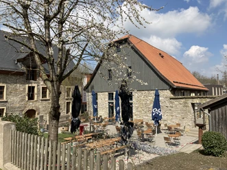
Stop at an Inn
Suitable for Bike
Equipment
- Round tour without major ascents. No special equipment required.
Directions & Parking facilities
- Getting thereA44 - exit Geseke/Steinhausen, then direction Steinhausen to Büren or exit Büren.ParkingParking lot at the Haus des Handwerks or at the Schützenhalle (Fürstenberger Straße).Public transportationStop: Büren, Alte Post
Nahverkehrsverbund Paderborn/Höxter
Always know what's running: The smart number for buses and trains in NRW 01803 504030 (timetable information for €0.09/min from a German landline, mobile max. €0.42/min) Additional information
Documents
License (master data)

Author´s Tip / Recommendation of the author
- In order to have fewer inclines, it is recommended to ride the circuit in a clockwise direction.
Safety guidelines
- Always pay attention to the road safety of your bicycle. For your own safety and as a role model, we recommend wearing a bicycle helmet.
Map
- Cycling map:
"The most beautiful cycle tours in the Paderborn region"
Scale 1:50,000 | ISBN 978-3-96990-031-4
Publisher: BVA Bike Media GmbH Social Media
Our recommendations



Download GPX file
Photo Gallery


