- 8:20 h
- 27.29 km
- 374 m
- 489 m
- 117 m
- 412 m
- 295 m
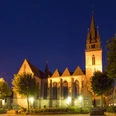
- Start: Parish Church of St. Peter and Paul (Lange Str. | Bad Driburg)
- Destination: Cathedral, Paderborn
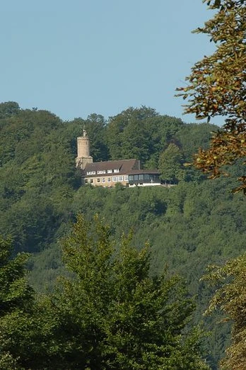
Pilgrimage and route traces: A 4.5 cm high and 2.5 cm wide lead pilgrimage sign was found at Iburg, southwest of Bad Driburg, whose St. Peter's Church probably dates back to the 8th century. The sign, which depicts a bishop with a staff and an unidentified person holding a chalice-like vessel, could not previously be assigned to a specific place of pilgrimage. Unfortunately, it is now lost and only survives in an illustration from 1905. It is dated to the 15th century. The main route of the Hellweg led over the Eggegebirgspass at the foot of the Iburg via Buke to the episcopal city. Traces of the route can still be seen in the area around the Brocksberg, where there was a hermitage, and the old gallows site near the former "Hengkrug" restaurant. A milestone on the B 64 a few hundred meters from the old Chaussee indicates where the Chaussee toll was collected in Prussian times. The Pamelsche Warte guarded the passage through the municipal land defense. As far as possible, the pilgrims' path follows a bariante to the south via Iburg and the former town of Schwaney and then deviates from the historical route to reach the cathedral city via Dahl and the Haxter Warte in the south-east of Paderborn. IN Paderborn, the Helllweg coming from Hameln/Höxter meets a branch coming from Magdeburg/Hildesheim.
Text: Altertumskommission für Westfalen/Ulrike Spichal, excerpt from: Landschaftsverband Westfalen-Lippe (ed.), Wege der Jakobspilger in Westfalen. In 9 stages from Höxter via Paderborn and Soest to Dortmund. Way of St. James Volume 8. Cologne 2010, p. XY
Waypoints
Good to know
Pavements
Best to visit
Directions
Starting point St. Peter and Paul, Bad Driburg: Lange Straße past the church, left An der Rote, left past the sports field, left Kapellenstraße, straight ahead, cross under the B 64, left up the hill, right uphill, at Sachsenklause follow the path around the Iburg on the right, at the turning loop follow the forest path parallel to the road on the left to the refuge, left past the refuge along the steep slope, fork left, fork right follow the path, fork left, fork left uphill, crossroads right uphill, crossroads right (Alter Klusweg), gravel path, pass the parking lot on the right, cross the railroad tracks, towards Schwaney via Am Rotenberg, left Agathastrasse, right Osttorstrasse, right Johannesstrasse, left Paderborner Strasse, exit left Alter Landdrostenweg, fork right Auf dem Heng, fork left follow the S-Kurzve, fork straight ahead, fork right, turn left, at the edge of the forest left, turn right, straight ahead into the village of Dahl, right Ellerstraße (K 38), left Ellerstraße, left Klünersweg, left Schlotmannstraße, straight ahead Grundweg, T-junction right, second possibility left along the stream, right, next fork left, at the Haxter Warte right Lichtenturmweg, cross B 64, right Im Lichtenfelde, cross Dahler Weg, straight ahead Brakeler Straße, after the traffic circle, follow the footpath downhill on the right, HOchstiftstraße on the left, follow the gravel footpath straight ahead in a left-hand bend, T-junction on the right, fork left (parallel to Ludwigsfelderring), Driburger Straße on the left, behind the Ludwigsfelder Ring bus stop turn right into the footpath (downhill), straight ahead Luise-Hensel-Straße, straight ahead Driburger Straße, straight ahead Giersstraße, left Heierstraße, right at the arch, cathedral.
Text: Altertumskommission für Westfalen/Ulrike Spichal, excerpt from: Landschaftsverband Westfalen-Lippe (ed.), Wege der Jakobspilger in Westfalen. In 9 stages from Höxter via Paderborn and Soest to Dortmund. Way of St. James Volume 8, Cologne 2010, p. XY.
Tour information
Stop at an Inn
Equipment
Directions & Parking facilities
From the B 64 (coming from Höxter): take the first exit off the B 64 ; follow Brakeler Straße; in a slight left-hand bend turn into Lange Straße; at the traffic light junction turn right into Konrad-Adenauer-Ring; follow the road to the end; turn left into Pyrmonter Straße; after approx. 150 m, turn left into Prälat-Zimmermann-Straße; there is a parking lot on the right-hand side next to the Church of St. Peter and Paul; however, parking here is only possible for a limited time!
From the parking lots described below (on foot): turn right from the parking lot; follow the Konrad-Adenauer-Ring to the end; turn left into Pyrmonter Straße; follow the road to Langen Straße; turn left into Lange Straße; after approx. 50 m you will find the Church of St. Peter and Paul on the left-hand side.
From the B 64 (coming from Höxter): take the first exit off the B 64 ; follow Brakeler Straße; take a slight left turn into Lange Straße; at the traffic light junction turn right into Konrad-Adenauer-Ring; shortly before you reach your destination, you will see Casper-Heinrich-Straße on the right, leave it behind you; shortly afterwards, there are also two smaller parking spaces on the right-hand side, which can be used without paying or using a parking disk.
Travel by bus (Haltestelle Rathaus): (Hourly bus connections (575 u. 576) from the train station or tourist information office to Reelsen); (with a view of the Town Hall) follow Langen Straße to the left; follow the road to the traffic light junction; cross the junction (the Konrad-Adenauer-Ring); turn into the pedestrian zone in Lange Straße; towards the end of the pedestrian zone (after approx. 300 m) you will see the Church of St. Peter and Paul on the right-hand side.
Additional information
Further information: "Jakobswege - Wege der Jakobuspilger in Westfalen Band 8", Landschaftsverband Westfalen-Lippe (ed.), J.P.Bachem Verlag (2010); (available at the Tourist Information Bad Driburg)
For more information on the Way of St. James and other hiking trails, please contact Bad Driburger Touristik GmbH - Tourist Information.
Further information on the Way of St. James and a list of current stamping points can be found at Landschaftsverband Westfalen-Lippe (LWL)
Literature
License (master data)
Map

