- 1:30 h
- 4.20 km
- 162 m
- 160 m
- 124 m
- 242 m
- 118 m
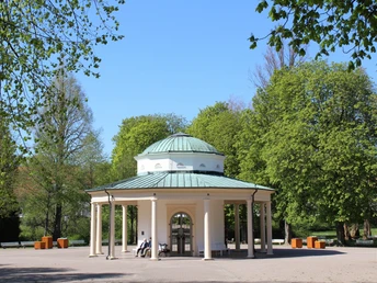
- Start: Fountain temple
- Destination: Fountain temple
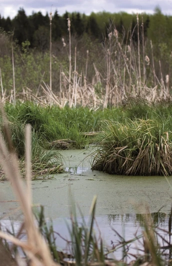
In performance group III, the Terrainkurweg no. 5 takes you to the southern part of Bad Meinberg in the direction of Moorstich. The pipelines that transported the mined sulphur moor to the adjoining spa clinics can be seen here in sections. With good visibility and a close look, you can see the Eggeturm tower of the Prussian twin peak Velmerstot on the highest elevation of the Eggegebirge at Blumenkamp. Past the "Meinberger Schweiz" restaurant, firm paths lead back to the village center.
Good to know
Pavements
Best to visit
Directions
Walk route: Brunnentempel - Allee - Marktstraße - Auf der Heide - Moorstich - Sonnenweg - Blumenkamp - Fischteiche - Meinberger Schweiz - Vahlhausener Straße - Seestraße - Brunnentempel
Tour information
Familiy-Friendly
Loop Road
Stop at an Inn
Directions & Parking facilities
Wherever you are traveling from, there are many ways to reach us
.By car
Coming from Kassel or the Ruhr area: via the A44 and A33 highways to exit 26 Paderborn-Elsen, from here via the B1 federal highway in the direction of Hameln/Detmoldaus towards Hanover, Berlin, Hamburg or Bremen: via the A2 highway to exit 35 Bad Eilsen, from here towards Rinteln, city bypass then via Barntrup and Blomberg towards Paderborn
Heinrich-Drake-Platz
Bus station
With the train
After traveling to Bielefeld or Paderborn on one of the fast trains, take the regional train line (Paderborn-)Altenbeken-Herford(-Bielefeld) to Horn-Bad Meinberg. Our train station in Horn, which does not have a ticket office, is usually served every half hour during the day. By busMany roads lead to Bad Meinberg. Find out more here:Kommunale Verkehrsgesellschaft Lippe - Tel.: +49 (0) 5261 / 6673950Stadtverkehr Detmold - Tel.: +49 (0) 5231 / 977177OWL Verkehr - Tel.: +49 (0) 521 / 5576660
License (master data)


