Telegraph road


- 4:44 h
- 17.86 km
- 246 m
- 207 m
- 157 m
- 323 m
- 166 m
- Start: At telegraph station no. 32 near Oeynhausen
- Destination: At telegraph station no. 30 on the Hungerberg near Marienmünster-Vörden
In 1833, the Prussian government issued an order to build an optical telegraph line from Berlin to Koblenz in order to provide a fast communication link. The telegraph line, which went into operation in 1834, consisted of 62 stations in particularly favorable topographical locations. A characteristic feature was the high mast with three double arms visible from afar. With the help of these so-called indicators, 1.5 to 2 characters per minute were transmitted to the next station, which was between 7.5 and 15 km away and usually located on a mountain. However, operation had to be stopped in fog or rain. After just 15 years, the entire optical telegraph line was shut down because electric telegraphy had been invented. The telegraph stations were demolished.
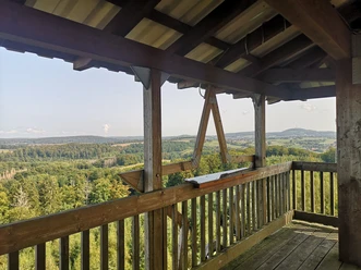
Newly erected observation towers at stations no. 30 and 32 provide a "view" of communication at that time. The rebuilt station no. 32 offers an insight into the life of the telegraph operator.

Waypoints
Good to know
Pavements
- Unknown (45%)Street (7%)Asphalt (5%)Gravel (34%)Trail (8%)Path (1%)
Best to visit
- suitableDepends on weather
Directions
- The path is currently being revised and is marked with a standardized sign.
Tour information
Stop at an Inn
Directions & Parking facilities
- Parking
Start at the hiking parking lot on the L755 (entrance to the Bilster Berg test track). Follow the N2a to the telegraph station
.At the end point: parking lot at Marienmünster Abbey or parking lot in the center of Marienmünster-Vörden.
Author´s Tip / Recommendation of the author
- Take binoculars with you. The telegraph poles are difficult to see with the naked eye.
Map
- Hiking in Nieheim (2015) - Available free of charge from the tourist office at Westfalen Culinarium Nieheim
Photo Gallery


