- 1:40 h
- 25.22 km
- 130 m
- 130 m
- 66 m
- 121 m
- 55 m
- Start: The cycle tour starts and ends at the new town hall at Rudolph-Brandes-Allee 19, 32105 Bad Salzuflen.
- Destination: The cycle tour starts and ends at the new town hall at Rudolph-Brandes-Allee 19, 32105 Bad Salzuflen.
In 2019, the large municipality of Bad Salzuflen celebrated its 50th anniversary.
To mark this anniversary, the ADFC Bad Salzuflen developed a route through the towns entitled: 12 towns, 1 cycle path. It was inaugurated in April 2019 in the presence of an ADFC cycling group.
This cycle path, in the shape of a horizontal figure of eight, can be divided into two stages. In a western part with a length of 25 km, in the east on a circuit of 27 km.
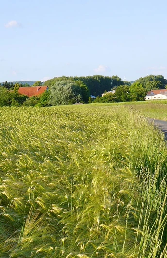
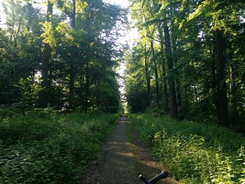
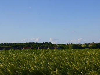
The character of the "lying eight" is the use of low-traffic roads through the settlements and communities. Cyclists trundle along asphalted country roads through the unique landscape of the Lippe district.
Each circuit can be cycled clockwise or anti-clockwise or supplemented with additional stops. It is also possible to shorten the routes.
Good to know
Best to visit
suitable
Depends on weather
Directions
The municipality of Bad Salzuflen celebrated its 50th anniversary in 2019.
To mark this anniversary, the ADFC Bad Salzuflen developed a route through the villages entitled: 12 villages, 1 cycle path. In April 2019, the cycle path was inaugurated in the presence of an ADFC cycling group.
This cycle path, in the shape of a horizontal figure of eight, can be divided into two stages. In a western part with a length of 25 km. In the east, a circular route of 27 km.
For the circular routes, we were looking for a cycle route along low-traffic, predominantly asphalted roads.
Each circular route can be ridden clockwise or anti-clockwise or supplemented with additional stops. It is also possible to shorten the routes. Ideal for families with small children or for sprightly pensioners.
Route markings
Local cycle route signs provide information about the cycle routes. Although the eastern and western circular routes of the "Lying Eight - 12 villages, 1 cycle path" are not signposted, they are easy to find based on the villages.
Tour information
Familiy-Friendly
Good Connection to public Transport
Loop Road
Possibility of Accommodation
Stop at an Inn
Suitable for Bike
Equipment
Wear clothing that is suitable for the weather for cycling tours. Don't forget drinks or snacks for on the way. In the vegetable-growing area south of Bad Salzuflen, farm cafés or farm stores also invite you to make a stop.
Directions & Parking facilities
You will find good parking options in parking garages, large parking lots or parking lots close to the city.
Travel comfortably by public transport and use the quiet electric buses from Stadtwerke Bad Salzuflen.
Additional information
Suitable for:
The cycle route in the west is recommended for all levels of difficulty. In contrast, the eastern figure eight is suitable for cyclists in good to very good physical condition. Alternatively, the use of a pedelec will help you climb the hills around Hollenstein.
The cycle route in the west is recommended for all levels of difficulty. In contrast, the eastern figure eight is suitable for cyclists in good to very good physical condition. Alternatively, the use of a pedelec will help you climb the hills around Hollenstein.
More information
The large municipality of Bad Salzuflen celebrated its 50th anniversary in 2019.
To mark this anniversary, the Bad Salzuflen ADFC developed a route through the towns entitled: 12 towns, 1 cycle path. It was inaugurated in April 2019 in the presence of an ADFC cycling group.
To mark this anniversary, the Bad Salzuflen ADFC developed a route through the towns entitled: 12 towns, 1 cycle path. It was inaugurated in April 2019 in the presence of an ADFC cycling group.
License (master data)
Teutoburg Forest - Bad Salzuflen - Kerstin Paar
Author´s Tip / Recommendation of the author
The "12 places, 1 cycle path" cycle path can be cycled in any direction. The local cycle route signposts provide orientation.
You can obtain further information and cycle route maps of the region from the Bad Salzuflen tourist information office.
You can obtain further information and cycle route maps of the region from the Bad Salzuflen tourist information office.
Map
You can download information about the tour as a PDF and GPX file.
Social Media


