Sachsenring Bad Driburg


- 6:00 h
- 18.24 km
- 387 m
- 381 m
- 192 m
- 343 m
- 151 m
- Start: Bad Driburg outdoor pool - Brunnenstrasse 32
- Destination: Bad Driburg outdoor pool
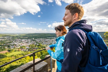
The Sachsenring runs within sight of Bad Driburg and thus offers you any number of shortcuts. A detour to the Iburg ruins and the Kaiser-Karls-Turm tower is definitely worthwhile and makes the tour a popular hiking trail alongside various rest areas and restaurants for a leisurely stop.
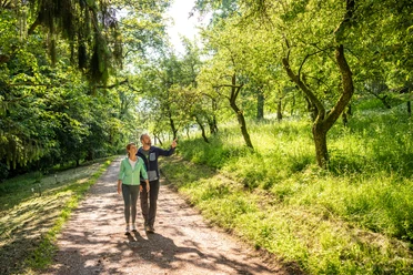
The hiking trail first takes you from the parking lot of the outdoor pool to the Reelser Kreuz, from where you have a wonderful view of the spa town and the wooded Eggewall with the Iburg. The final point is the Steinberg, which offers you a wide view of the Emderhöhe and the silhouettes of the Nethegau from the Arboretum tree park.
At the Bollerwien spring with its treading pool and benches as well as at other shelters along the way, you have the opportunity to linger.
The Sachsenring trail sign is the circled white S on a black background.
Waypoints

Good to know
Pavements
Best to visit
Directions
Route markings
Tour information
Familiy-Friendly
Loop Road
Stop at an Inn
Directions & Parking facilities
A33, exit PB Zentrum, continue on B 64 to Bad Driburg
.Freizeitbad Bad Driburg | Brunnenstraße 32 | 33014 Bad Driburg
Bad Driburg has its own train stop and is integrated into the existing hourly NordWestBahn timetable.
The starting point at the leisure pool is about 15 minutes' walk from the train station. Follow Bahnhofstraße to the tourist information office and from here continue along Brunnenstraße along Gräflicher Park to the leisure pool.
You also have the option of taking the R75 and R76 bus routes and, on weekdays, the city bus to the outdoor pool stop.
Timetables can be found at www.fahr-mit.de or by phone: Die Schlaue Nummer für Bus und Bahn in NRW 01803 504030 (timetable information for €0.09/min from a German landline, mobile max. €0.42/min).
Additional information
For more information on hiking around Bad Driburg in the Teutoburg Forest / Eggegebirge Nature Park, please contact Bad Driburger Touristik GmbH - Tourist Information.
Literature
License (master data)

Author´s Tip / Recommendation of the author
Map
Tourist map Bad Driburg on a scale of 1:20,000 (hiking and cycling map, walking routes & city map)
Available from Bad Driburger Touristik GmbH
Download GPX file
Photo Gallery


