Pivitker Wasserweg


- 1:30 h
- 5.70 km
- 141 m
- 141 m
- 143 m
- 196 m
- 53 m
- Start: Parking lot "Donoper Teich", Stoddartstraße, 32760 Detmold
- Destination: Parking lot "Donoper Teich", Stoddartstraße, 32760 Detmold


Waypoints
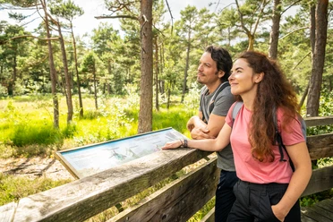
Good to know
Pavements
Best to visit
Directions
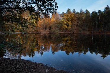
The Pivitker Wasserweg starts directly at the "Donoper Teich" parking lot. The Donoper pond and the surrounding area were placed under protection in April 1950 together with the HiddeserBent. At the behest of Simon VII, it was dammed for fish farming during the Thirty Years' War (1618-1648) and named after the chamberlain of Donop. Due to its scenic diversity and beauty, the Donop pond is one of the most popular excursion destinations in Lippe.
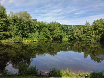
You walk past the Donop pond and keep to the right. Follow the Hermannsweg towards the Krebsteich pond. The Krebsteich was used for a long time for crayfish farming due to its nutrient-poor moor water.
At the Krebsteig, leave the Hermannsweg and keep left until you reach the Panoramaweg. The Panoramaweg leads you back towards Donoper Teich.
At Donoper Teich, turn right and you will soon come to the "Eisenhaltige Quelle". The iron spring is located in the immediate vicinity of Donoper Pond and can still be visited today. As early as the beginning of the 17th century, the spring was set in the form of a stone vase, which has a rusty color due to the high iron content in the water. The spring quickly developed into a health fountain, but fell into oblivion over time.
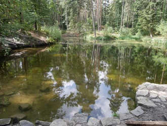
Now leave the iron-rich spring behind you and follow the Hasselbach stream to the Hasselbach reservoir. The path leads you past the The Hasselbach is a left tributary of the Werre with a length of approx. 6.5 km. The name "Hasselbach" refers to the former horse breeding of the Senner horses, as "Hassel" means "foal" in Low German. A paper mill was built on today's Hasselbach reservoir in 1674, which was later converted into a furniture factory and, after several expansions, continued to produce until 1965.Cross the Hasselbach reservoir over a bridge in the direction of the main road, which you now cross in the direction of the "Waldfriedhof" parking lot. You then pass the parking lot and enter the forest again. Continue following the markings until you reach the Blauer See lake. The Blause See is known for its crystal-clear water, which you walk along on its left-hand side and which gradually develops into a stream. Following the Blauer Bach, keep left until you reach the Hermannsweg trail again.
Following the Hermannsweg and the markings, you will reach your starting point again.Tour information
Familiy-Friendly
Loop Road
Mainly Shady
Premium Trail "Wanderbares Deutschland"
Stop at an Inn
Directions & Parking facilities
- "Donoper Teich" car park
- "Forstfrieden" car park
- "Waldfriedhof" car park
More information
License (master data)
created by LTM GmbH

Author´s Tip / Recommendation of the author
Before you follow the Panorama Trail, it's worth taking a detour to Hiddeser Bent! Simply follow the destination signpost in the direction of "Moorsteg, Hiddeser Bent".
The Hiddeser Bent has been a nature reserve since 1950 and is the last surviving hillside moor in the Teutoburg Forest. The word "Bent" means "peaty moor", which has formed here since 7,000 BC. Peat was mined here for many decades, resulting in numerous hillside terraces. After peat extraction ceased, a large area was reforested with spruce and pine trees. Many rare plant species grow in the unwooded area, including 13 different species of peat moss and the insect-catching sundew. On the northern edge of the bent there is a viewing platform set up by the Lippe Biological Station and the nature park, which offers sweeping views across the moor.Download GPX file
Photo Gallery


