- 1:30 h
- 5.57 km
- 104 m
- 104 m
- 153 m
- 257 m
- 104 m
- Start: Oerlinghausen Hikers' parking lot Bartholdskrug
- Destination: Circular hiking trail Starting point = destination
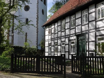
The A6 circular hiking trail begins at the Bartholdskrug, an old half-timbered inn dating back to 1713. The jug was a customs post on the border between Lippe and Prussia. Around 1818, when Prussia introduced strict import duties, a lively smuggling trade developed from Lippe to Prussia and the Bartholdskrug gained a reputation as a smugglers' nest.
The carters came via the Senner Hellweg, an old military and trade route. The Hellweg is one of the oldest long-distance routes south of the Teutoburg Forest. You follow the Senner Hellweg in a north-westerly direction. After approx. 450 m, you cross a wooden bridge over the Menkhauser stream. This stream is also called Schopke (Schafsbach). The name indicates that large flocks of sheep from the Senne used to be washed here before being driven to Paderborn to be sold at the sheep market.
Under the bridge, the water is divided and continues to flow in two streams. With a bit of luck, you may spot the dipper here.
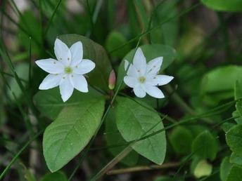
Follow the signs to Haus Neuland. This is where the typical Senna pine forest begins. Blueberries grow on the sparse sandy soil and in spring, you can spot the seven-pointed star here. This has a small star-shaped flower consisting of 7 petals. However, if you count, you will also find six and eight petals. Follow the A6 until you reach the stream again at a reddish half-timbered house, which is called "Schopke" here. There is a spring pot on the left behind the bridge. When the spring bubbles, the sand at the bottom is stirred up.
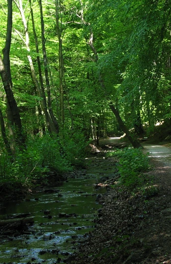
Then walk along the banks of the Schopkebach stream. After approx. 150 m, there is an old boundary stone on the left-hand side. It marks the border between Lippe and Prussia. The beech forest of the Menkhauser Berg extends along the slope on the right-hand side. The limestone of the southern chain of the Teutoburg Forest is visible at some small outcrops.
Passing the former "Schopketal" restaurant - now home to a dog training school - we reach a T-junction. Opposite is the notch valley of the Schopkebach stream. Turn right. An impressive beech tree shows its roots, which have been washed free by wind and rain. Behind it on the right is the cemetery mill, an old oil mill that has been converted into a residential building. The pumping station in the small white-green house made it possible to supply water to Oerlinghausen from 1912. From here, the water was pumped into an elevated tank on the Tönsberg and could be distributed to households from there. Now leave the Schopke valley via the A6. This is followed by the ascent to Oerlinghausen and the Alexanderkirche church. On the way back, the A6 leads along the old Lipperreiher Kirch- und Leichweg. This path was used by the inhabitants of the Senne in the vicinity of the Bartholdskrug to get to Oerlinghausen for church services and to bring their dead to the cemetery, which was located around the church until 1860. The route leads through the "Kirchtwete" via the "Göddernstraße" to the Schützenhaus on the Steinbült. The A6 leads over the crest of the Menkhauser Berg back downhill into the Senne. We soon walk parallel to Tunnelstraße. This road was built between 1993 and 1997. A tunnel 492 m long had to be driven through the limestone of the Menkhauser Berg. At the path "Unter dem Menkhauser Berg", we turn right under the tunnel road. Turn left at a refuge. This is where the pine forest begins again. We return to the Bartholdskrug hiking parking lot via sandy paths.Waypoints
Good to know
Best to visit
Directions
The hiking trail is very well marked so that it can be walked without a map or description.
Short description > A6 markings > from the parking lot, cross the "Senner Hellweg" road to Bartholdskrug > turn right along the Senner Hellweg towards Sennestadt > cross the Menkhauser Bach bridge > follow the "Haus Neuland" signs to the right > straight ahead into the pine forest > follow the A6 signs > then turn right down into the Schopketal valley > cross the stream and follow the course of the stream to the left > at a T-crossing on the right past the cemetery mill > turn right at the fork under a bridge > turn left up to Oerlinghausen > cross Robert-Koch-Straße > cross towards the church via the "Wehme" paths > turn right "Unter der Howe" > turn left "Pfarrstraße" > at the fountain turn right towards the church > cross the "Kirchtwete" and "Göddernstraße" downhill > cross the road > continue left "Göddernstraße" > uphill past the Schützenplatz into the forest > follow A6 over the Menkhauser Berg > parallel to the tunnel road > turn right on the crossover > through the underpass to the refuge > left downhill to the "Bartholdskrug" hikers' car park
.Tour information
Familiy-Friendly
Loop Road
Stop at an Inn
Equipment
Directions & Parking facilities
via A2 - exit 27, Bielefeld Zentrum - B66 towards Oerlinghausen - exit towards Oerlinghausen - after approx. 4.7 km on L751/Tunnelstraße - after approx. 4.3 km turn right at the traffic lights towards Bielefeld Sennestadt - after 700m hikers' parking lot on the right-hand side opposite "Bartholdskrug"
Hike also from Oerlinghausen/Simonsplatz, here public transport line 39
Additional information
Author´s Tip / Recommendation of the author
Unfortunately, it is currently not possible to stop off at the Bartholdskrug. It is closed b.a.w.!
Other places to stop for refreshments: Old Town Oerlinghausen special lunch/snacks at Brinkmanns Backstube, Rathausstr. 5, 33813 Oerlinghausen, Café Kriemelmann, Hauptstraße 22, 33813 Oerlinghausen
Lunch at Haus Neuland "Hermannsküche" https://www.haus-neuland.de/tagungshaus/essen-und-trinken
Safety guidelines


