- 6:00 h
- 16.08 km
- 229 m
- 210 m
- 315 m
- 420 m
- 105 m
- Start: Bad Driburg, Iburg ruins
- Destination: Willebadessen, transmission tower
The stage at a glance:
1. Start and finish point of the stage
The stage starts at the Iburg ruins above Bad Driburg and ends in the center of Willebadessen.
2. Length of the stage in kilometers / elevation gain / route character
The stage is around 16 kilometers long and has a moderate ascent. The route leads mostly through wooded areas and is characterized by narrow paths and rooted trails. There are around 230 meters of elevation gain to overcome on this stage.
3. Scenic features
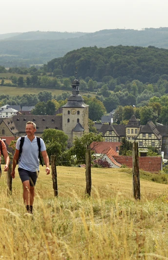
You will cross wooded areas on this stage, some of which are undergoing reforestation. At numerous points, you can enjoy views far into the surrounding area over the regrowing greenery. A fabulously beautiful forest awaits you at the Teufelsküche along rooted paths. Here you hike along a precipice edge, which is partly secured with fences.
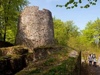
- The Iburg on a rocky outcrop with an impressive ruin of a former Saxon folk castle and the Kaiser-Karls-Turm, which offers a beautiful view of the spa town of Bad Driburg.
- The mighty church Eggedom of the former Neuenheerse Abbey is an impressive sight. The collegiate church has one of the oldest and most valuable relic treasures as well as the oldest bishop's seal imprint in Germany. The nearby water castle is also worth a visit.
- The former Benedictine convent of Willebadessen is an impressive building with convent buildings and a Romanesque church. It is worth visiting the grounds here.
Waypoints
Good to know
Pavements
Best to visit
Directions
The access trail from the town center of Bad Driburg also leads you to the starting point of the stage.
At the end of the stage, hike towards the town center of Willebadessen.
On this stage, you will find the following quality establishments of the Hermannshöhen:
Bad Driburg
- OT Reelsen: Pension-Café-Restaurant Ethner, www.pension-ethner.de, Tel. 05253 98320
- Landhotel Der Schwallenhof, https://schwallenhof.de , Tel. 05253 981300
- Hotel B-vier, B-vier Hotel Bad Driburg, Tel. 05253-9810
Willebadessen
- Avenarius Wohlfühlhotel DER JÄGERHOF, www.jaegerhof-willebadessen.de, Tel. 05646 - 8010
Tour information
Cultural Interesting
Possibility of Accommodation
Premium Trail "Wanderbares Deutschland"
Tour with Dog
Directions & Parking facilities
Wanderparkplatz Alter Postweg
Westenfeldmark 4,
33014 Bad Driburg
directly along the way
Bus stopBad Driburg, Eggeweg431 Paderborn - Altenbeken - Bad Driburg
S30 Paderborn - Bad DriburgWanderparkplatz Schöne Aussicht
Westenfeldmark,
33014 Bad Driburg
direkt am Weg
Keinbindung an Nahverkehr vorhanden!!
Hiking parking spaces along the route:
Wanderparkplatz Radbaum
L828 opposite the junction towards Herbram-Wald
Bus stop Bad Driburg-Neuenheerse, Radbaum
Parking lot Herbram-Wald
Erlenweg 3,
33165 Lichtenau
Bus stopHerbram-Wald, Wendeplatz
R31 Altenbeken - Bad Driburg - Willebadessen432 Paderborn - Willebadessen
FahrplanauskunftWanderparkplatz Lichtenauer Kreuz
Lichtenauer Kreuz,
34439 Willebadessen (K26 direction Lichtenau)
Link to TEUTO_Navigator
No connection to local transport available!!Parking lot Willebadessen train station
Am Bahnhof 1,
34439 Willebadessen
Willebadessen train station
Detailed information about your journey by bus and train can be found here.
The smart number for bus and train in NRW:
Always know what's running: The smart number for buses and trains in NRW
08006 - 50 40 30 (free of charge from the German landline network).
Additional information
License (master data)
Safety guidelines
The following rescue points have been registered with the emergency call center on this stage:
Schöne Aussicht, Klusenberg Hütte, Radbaum Hütte, Herbram Wald, Asselner Hütte, Paderborner-Berg-Hütte, Willebadessener Hütte, Johann Kiene Hütte
Our recommendations
