ClimateExperienceRoute 2: Velmerstot

GPX

PDF

17.30 km long
round trip
Difficulty: difficult
condition: difficult
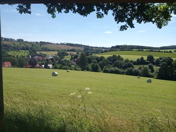
Great panorama
Regional hiking trail
  • 04:44 h
  • 352 m
  • 352 m
  • 307 m
  • 468 m
  • 161 m
  • 17.30 km
  • Start: Buchenberg hiking parking lot in Veldrom (near Kattenmühle)
On the 17 km long ClimateExperienceRoute 2: Velmerstot, you will learn a lot about the effects of weather, climate and air quality on your body.
Another focus is on climate change and its consequences for nature, land use and people.
We show you developments in the landscape that allow you to recognize how we are already reacting to climate change.

Please use our interactive app, which provides orientation and further information on site.
 
You can download the app here:
For Android devices: https://play.google.com/store/apps/details?id=mobi.sawah.klimaerlebnis&hl=en_CH
For Apple devices: https://apps.apple.com/de/app/klimaerlebniswandern/id1478310732
 
In addition to the app, the accompanying hiking booklet offers lots of in-depth information.
The 5 ClimateExperienceRoutes can be downloaded individually as PDF files here: KlimaErlebnisWandern - Naturpark Teutoburger Wald/Eggegebirge (naturpark-teutoburgerwald.de)
 
You can also order the entire brochure as a print product from the nature park. Simply send a short email to info@naturpark-teutoburgerwald.de .


The fascinating interactions between climate, nature and human health are made visible and tangible along the ClimateExperienceRoutes. Here you can learn, among other things, how the climate conditions from historical times are still reflected in the landscape today and how today's climate conditions influence the flora and fauna, as well as humans.

Laying limestones or oak trunks, which are numbered consecutively, indicate climatic phenomena along the way. The main theme is climate change and its impact on the landscape and people

Note: Unfortunately, the Eggeturm cannot currently be climbed due to fire damage.

Good to know

Best to visit

suitable
Depends on weather

Directions

The Velmerstot route takes you around the Veldrom valley. First, the trail takes you through parts of the Silberbach Valley and then up to the northernmost mountain in the Egge Mountains, the Lippische Velmerstot. Via the Preußischer Velmerstot, the highest
mountain in the Egge, and the Kammweg trail, you descend to Kempen and from there via the Köhlerberg, Spellerberg and Bauernkamp as well as the Eggeberg and Ebersberg back to the Kattenmühle.

Tour information

  • Loop Road

  • Premium Trail "Wanderbares Deutschland"

  • Stop at an Inn

Directions & Parking facilities

From Horn via the L828; at the entrance to Veldrom, turn left towards Kattenmühle.

From Paderborn via the K98

.
Parking is available at the starting point of the ClimateExperienceRoute, the Buchenberg hiking parking lot in Veldrom (near Kattenmühle). Further hiking parking lots with a connection to the Velmerstot Climate Experience Route can be found east of Kempen on the L828 and at Bauernkamp on the K98.

Additional information

Teutoburg Forest / Eggegebirge Nature Park
Grotenburg 52
32760 Detmold

www.naturpark-teutoburgerwald.de

Literature

You can find all the information about ClimateExperienceHiking in the brochure: "ClimateExperienceHiking in the Teutoburg Forest/Egge Mountains Nature Park" or at "www.naturpark-teutoburgerwald.de".

Hiking flyer: https://www.naturpark-teutoburgerwald.de/wp-content/uploads/2018/01/Flyer_Klima_Velmerstot_.pdf

Author´s Tip / Recommendation of the author

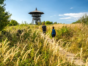
From the 17-metre-high Eggeturm tower built in 2003 on the Prussian Velmerstot, you have an excellent view of the Senne, the Lipper Bergland and Weserbergland and the Sauerland in good weather (CURRENTLY NOT ACCESSIBLE due to a fire).


At the halfway point, you can take a look at the tractor museum in Kempen. On display are around 60 tractors from all over the world and over 100 old agricultural implements and everyday objects.
Getting there
ClimateExperienceRoute 2: Velmerstot
32805 Horn-Bad Meinberg