Circular hiking trail A2 - Hermann-Heidental-Route

- 2:40 h
- 5.40 km
- 197 m
- 197 m
- 189 m
- 379 m
- 190 m
- Start: Hermannsdenkmal parking lot, Grotenburg 50, 32760 Detmold
- Destination: Hermannsdenkmal parking lot, Grotenburg 50, 32760 Detmold
Waypoints
Good to know
Pavements
Best to visit
Directions
Shortly after the Bandelhütte, we turn right onto the Hermannsweg (H) and walk around the monument, which is now on the left. We pass the Waldbühne and reach the road and continue downhill along the Hermannsweg towards the Vogelpark. After passing another parking lot on the left, we turn onto the A2, also known as the Kaiser-Wilhelm-Weg, at the bend. We follow this until the next T-junction, where we meet the Hermannsweg again. Here we turn left and walk down the hill until we reach a narrow tarmac road, Heidentalstraße, which we cross (following the A2).
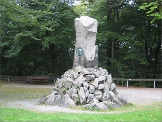
At the Mufflonkamp barbecue area (Schützhütte!) we recognize the road to the Hermannsdenkmal in a bend. We cross the road and come through a narrow passage into the Maiweg, which is later marked as A2. Above Hiddesen, we now walk with a wonderful view of Detmold to the end of the residential area. Once back in the forest, we have to turn right at a T-junction onto the E1/X3. We follow this path uphill until we reach the top again. On the way, after crossing the road, we see the "Großer and Kleiner Hünenring". These are two hill forts on the Grotenburg castle at the foot of the Hermann monument. Information boards provide further information.
At the Bismarckstein we reach the area around the Hermann monument again. It is probably the most famous excursion destination in Detmold and stands on the 356m high Grotenburg. Since its inauguration 125 years ago, the Hermann Monument has become one of the most important excursion destinations in northern Germany. Thanks to the extensive expansion of the catering facilities and the careful creation of hiking trails of varying lengths, the landmark of the Teutoburg Forest also invites visitors to linger for longer.
Further information about the Hermannsdenkmal can be found here: www.hermannsdenkmal.de
At the foot of the "Hermann" is the Teuto climbing park. Here, young and old can climb to their heart's content on three different levels in the living trees.
Tour information
Loop Road
Stop at an Inn
Directions & Parking facilities
For central information on public transport, please use the "Schlaue Nummer" for bus and train:
0180 6 50 40 30 (20 cents/call from a German landline, mobile max. 60 cents/call).
Electronic timetable information: 0800 3 50 40 30 (free of charge)
Timetable information online: www.TeutoOWL.de
Additional information
License (master data)
Tourist Information Lippe & Detmold

Author´s Tip / Recommendation of the author
Map
Download GPX file
Photo Gallery


