Circular hike Bad Driburg - Neuenheerse with Eggeweg trail

GPX

PDF

25.28 km long
round trip
Difficulty: difficult
condition: very difficult
Great panorama
Regional hiking trail
  • 08:00 h
  • 609 m
  • 609 m
  • 193 m
  • 418 m
  • 225 m
  • 25.28 km
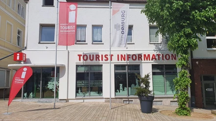
  • Start: Bad Driburger Touristik GmbH - Tourist Information
Hike a section of the Eggeweg quality trail on this circular route and enjoy wonderful views from the Eggekamm ridge. From Neuenheerse, the Annette-von-Droste-Hülshoff trail leads back to Bad Driburg.

Bad Driburg is perfect for a variety-packed day of hiking: the moorland and mineral spa is located directly on the Eggeweg, the first hiking trail to be awarded the "Wanderbares Deutschland" quality seal by the German Hiking Association, so put on your hiking boots and hike a section of this award-winning trail. Then follow a section of the Annette von Droste-Hülshoff trail, named after Germany's great poetess, from Neuenheerse back to Bad Driburg.

Waypoints

Start
Bad Driburger Touristik GmbH - Tourist Information
Tourist Information Bad Driburg
Tourist information

Good to know

Best to visit

suitable
Depends on weather

Directions

From the TouristInformation via Lange Straße > after the Zur Linde restaurant turn left into Schützenstraße > at Schützenplatz turn right uphill to the Iburg > along the Iburg along the moat to the parking lot > 500 m further on turn left through tall beech forest > over the ridge to a stepped drop > at the refuge "Schöne Aussicht" on the Eggeweg (X) > in a southerly direction along the steep slope > after overcoming a small incline after the beech forest, you reach the Klusenberg > in a large arc west around the Ochsenberg into the Bodental valley > then along a forest road > cross the Neuenheerse-Schwaney > footpath to the right of the road towards Herbram Wald > after 20 min. Arrival Herbram Wald

From here Annette-von-Droste Hülshoff-path towards Neuenheerse > from the road junction, take the path uphill alongside the road > from Königsplatz via Grasweg to the old brickworks on the K 13 > eastwards through the valley to Neuenheerse > via Stiftsstrasse and Sonnenweg towards Kühlsen > cross the K 13 > at Steinberg turn left into Werntzeweg > from Fielenbusch downhill to Oesebrücke bridge > past Suffelmühle mill and Antoniuskapelle chapel > after 3/4 hour and a steeper descent, cross Dringenberger Strasse > Siebenstern > left along the stream > after 10 min. right after the B 64 underpass > over two streams on a small footpath through meadows > past the train station back to the tourist information office

Tour information

  • Loop Road

Directions & Parking facilities

B 64 coming from Paderborn and exit Bad Driburg,
in the town follow signs "i - Tourist-Information".
Parking spaces directly at the Tourist Information
Bad Driburg has its own train station and is integrated into the existing hourly timetable of Deutsche Bahn and NordWestBahn. The tourist information office is just a few minutes' walk from the station.

Additional information

Further information on hiking around Bad Driburg in the Teutoburg Forest / Eggegebirge Nature Park is available from Bad Driburger Touristik GmbH - Tourist Information

Literature

Bad Driburg - Count's private spa in the Teutoburg Forest / Eggegebirge Nature Park (2009),
BAD DRIBURGER TOURISTIK GMBH (ed.), Jörg Mitzkat publishing house
ISBN: 978-3-940751-19-5

Travel guide Teutoburg Forest / Eggegebirge Nature Park (2009)
Teutoburg Forest / Eggegebirge Nature Park (ed.)
ISBN 978-3-936359-34-3

The Eggegebirge and its foothills. Lippert hiking guide (1996, 5th ed.)
Eggegebirgsverein, Willy Lippert

Map

Bad Driburg town map with hiking and cycling map, 1:20,000
available from Bad Driburger Touristik GmbH - Tourist Information

Leisure and hiking map "Oberwälder Land", 1 : 50 000
Hiking map "Eggegebirge North", 1 : 25 000
Getting there
Circular hike Bad Driburg - Neuenheerse with Eggeweg trail
33014 Bad Driburg