- 8:11 h
- 26.65 km
- 900 m
- 558 m
- 121 m
- 478 m
- 357 m
- Start: Bus stop Schieder-Schwalenberg, Gasthaus Nessenberg
- Destination: Köterberg summit, Lügde
++ Attention bridge Nessenberg closed. We currently recommend starting in Schieder ++
We start at the former inn "Nessenberg", today "Elfenberg" on the L 886 and hike slightly uphill along the Emmer from the confluence of the Diestel. From the top, the path leads down through the unspoilt Niese valley to the Papiermühle Plöger - a cultural monument and technology museum. ( www.papiermuehle-ploeger.de ).
On arrival in Schieder, we enjoy the views of Schloss Schieder,
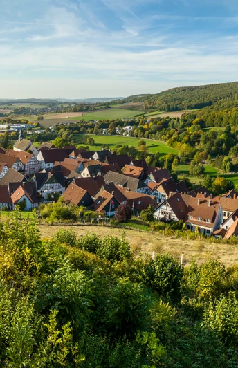
https://de.wikipedia.org/wiki/Schloss_Schieder, the castle was built by Joseph Falck and was the summer residence of Princess Pauline zur Lippe. Between 1701 and 1706, a garden was built in the Baroque style before we pass the mill pond of the old Brenker mill, fed and derived from the Schweibach stream, above the center of the town of Schieder. Past the remains of the former fortification "Alt Schieder", the path leads us along the edge of the forest with beautiful views towards Brakelsiek, a district of the town of Schieder-Schwalenberg, to the Magdalenenquelle spring.
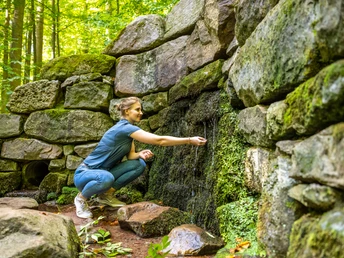
The installation of the town water supply in Schwalenberg is considered an outstanding technical-historical achievement of the Middle Ages. Its origins are attributed to Cistercian monks. The open moat supplied the town with vital water over a distance of 2.2 km - a major challenge for the time, as the difference in altitude from the Magdalenen spring to the edge of the town was only 10 meters. From there, the water "falls" a further 10 meters, until it flows into the "Volkwin Fountain" in the old town on the market square, supplying the town with the necessary water for people and animals.
We follow the course of the town water until we make a detour to the "Grafenblick" to Schwalenberg Castle. The fantastic view from here over the south-east of Lippe makes up for the effort of the ascent.
Downhill, through the half-timbered town of Schwalenberg past the Schwalenberg Town Hall with its richly carved façade (built in 1579), the path leads slightly uphill towards Dohlenberg and on through the NSG Salkenbruch (a closed forest area), crosses the Steinbach stream and after the Biesterfeld pond reaches the former manor house of Lippe-Biesterfeld, line Lippe-Weissenfeld and Prince Stefan zur Lippe.
We rest under the Marienlinde lime tree in front of the former forester's lodge of the Domäne Biesterfeld, around 700 years old and one of the oldest lime trees in Germany.
Behind Biesterfeld, the ascent to the Scharpenberg begins with breathtaking views of the Niese valley and (in the foreground) the village of Niese, a district of the town of Lügde.
After a short hike through open fields, we pass the Frettholz and reach the village of Köterberg, also part of the town of Lügde.
It is worth making a detour to the Dreiherrenstein, which marks the point where the North Rhine-Westphalian districts of Lippe in the north and Höxter in the south meet the district of Holzminden in Lower Saxony, not far from the summit.
With our destination, the transmission tower, the Köterberghaus and the "panorama window" on the Köterberg already in sight, we climb up to the Köterberg, the highest mountain in the Lippe region at 496 m.
The fantastic views from the Köterberg range from the Hermann monument in Detmold and the Porta Westfalica to the Hercules near Kassel and the Brocken in the Harz mountains.
Good to know
Best to visit
suitable
Depends on weather
Directions & Parking facilities
https://teutoowl.de/fahrt/fahrplanauskunft/
Connection: Schieder station, Blomberg, Detmold
GPS: ETRS89/UTM zone 32N 508691;5751236
Connection: Schieder station, Blomberg, Detmold
GPS: ETRS89/UTM zone 32N 508691;5751236
Contact person
Lippe Tourismus & Marketing GmbH
Mr. Jan Wisomiersky
Grotenburg 52
32760 Detmold
License (master data)


