Bad Driburger Radroute, Tour 3

GPX

PDF

Bookmark

27.79 km long
round trip
Difficulty: medium
condition: medium
Regional bike tour
  • 07:28 h
  • 372 m
  • 373 m
  • 202 m
  • 313 m
  • 111 m
  • 27.79 km
  • Start: Pavilion at the level crossing (Lange Str. 140)
  • Destination: Pavilion at the level crossing
Bad Driburg has an extensive, signposted network of cycle paths that offer a wide range of opportunities for cycling and hiking. To the east, you can take a leisurely ride through the countryside to the Weser, while the west is a challenge for experienced cyclists and mountain bikers in particular will get their money's worth here. On this tour, conquer the defiant Dringenberg Castle as a modern bike knight on the saddle of your steel steed, after crossing the tranquil Ösetal valley and enjoying wonderful views.

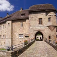
From the pavilion at the level crossing, you first head south on the R2. At the Antonius Chapel - a chapel dedicated to St. Anthony of Padua in an idyllic location in a small mixed forest - there is an opportunity for a short stop before you enter the tranquil Ösetal valley. After looking out of the valley at the Bad Driburg district of Dringenberg with its defiant castle, turn right to enjoy the view from the chapel hill at Altenheerse. Back in the Öse valley, cross the Öse ford or take the path over the pedestrian bridge and face the steep climb to the mountain village. At the top, reward yourself with a short tour of Dringenberg. Here you should visit the castle and the old town hall, where regular (art) exhibitions are held. The highlight is the castle courtyard and the view into the deep well.


Waypoints

Start
Pavilion at the level crossing (Lange Str. 140)
© Bad Driburger Touristik GmbH
Tourist Information Bad Driburg
Tourist information

Good to know

Best to visit

suitable
Depends on weather

Directions

Pavilion at the level crossing - turn left over the R 2 towards Neuenheerse - keep left until above Antoniuskapelle - keep left - towards Dringenberg on the L953 - before entering the village turn right towards Kühlsen - through the village - after about 1 km turn left towards Altenheerse - at the entrance to the village turn left into Kirchring - Am Himmelsberg - Rotheweg - towards Dringenberg - keep right at the Oese - after about 200 m turn left - take the "Wanderweg" left into Burgstraße, left "Zum Stadttor" - direction L953 and return in reverse order.

Tour information

  • Loop Road

Directions & Parking facilities

Coming from the B 64 from Paderborn, take the Bad Driburg - Kurgebiet exit and follow Brakeler Straße until you cross the level crossing.
Parking directly at the pavilion at the railroad crossing.

Bad Driburg has its own train station and is integrated into the existing hourly timetable of Deutsche Bahn and NordWestBahn. The pavilion at the level crossing is just a few minutes' walk from the station.

Additional information

Further information on cycling around Bad Driburg in the Teutoburg Forest / Eggegebirge Nature Park can be obtained from Bad Driburger Touristik GmbH - Tourist Information.

Literature

Bad Driburg - Count's private spa in the Teutoburg Forest / Eggegebirge Nature Park (2009),
BAD DRIBURGER TOURISTIK GMBH, Jörg Mitzkat publishing house
ISBN: 978-3-940751-19-5

Travel guide Teutoburg Forest / Eggegebirge Nature Park (2009)
Teutoburg Forest / Eggegebirge Nature Park (ed.)
ISBN 978-3-936359-34-3

Map

Bad Driburg town map with hiking and cycling map, 1:20,000
available from Bad Driburger Touristik GmbH - Tourist Information

Recreational and hiking map "Oberwälder Land", 1 : 50 000
Getting there
Bad Driburger Radroute, Tour 3
33014 Bad Driburg
Bad Salzuflen: feel-good place
Our tip

Nature without detours

© Teutoburger Wald Tourismus / D. Ketz
Experience nature
Our tip

Exciting quality hiking trails

© Touristikzentrum Westliches Weserbergland
Travel planning on the road

Teuto-Navigator ►

© Teutoburger Wald Tourismus / D. Ketz