- 03:29 h
- 217 m
- 188 m
- 82 m
- 258 m
- 176 m
- 12.26 km
- Start: Spa park entrance at the spa park lake
- Destination: Spa park entrance at the spa park lake
Ahead to fantastic views from the heights
The 12 km hiking trail starts at the large hiking board at the transition from the Kurpark to the landscape garden.First we walk along the eastern shore, between the Kurparksee and Salze. The view sweeps over the fountain of the expansive Kurparksee lake and, to the right, the Strandhaus and the Hortus Vitalis garden labyrinth.
At the end of the Kurparksee lake, we cross the Salze and now follow the hiking trail to the east.
As soon as we see the game reserve, signs point us up the hill to the right. But first, you should definitely take a photo stop at the fence of the game reserve and observe the graceful fallow deer.
From the landscape garden to the Vierenberg
After the short climb, we reach the restaurant "Zum Stumpfen Turm" on the right. We turn left onto "Alte Vlothoer Straße" to the hiking parking lot.The next section of the trail leads us through meadows to the Salzufler Stadtwald forest and the first foothills of the Vierenberg (223 m). We follow the Heuweg for a short distance until the Salzeweg turns off to the left. In front of us we see the municipality of Waldemeine on the left and Wüsten on the right. In a gentle bend to the right, the hiking trail follows the Vierenberg and parallel to Salzufler Straße. Before reaching the village of Wüsten, we take a sharp right turn. The forest path winds its way up around 220 m to the Vierenberg.
Enjoyable hike with far-reaching views
In the Salzufler Stadtwald hiking paradise, hikers are treated to numerous views. We also cross other hiking trails in the city forest, such as the well-known Hansaweg long-distance hiking trail or the Karl Bachler Trail.In the footsteps of the hiking father
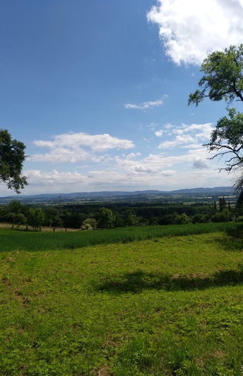
We reach a highlight at Hühnerwiem. At this viewing and resting point, we not only enjoy the distant view of the municipality of Wüsten or as far as the Weserbergland, but can also discover a memorial stone. The Hühnerwiem memorial stone is located under a tree near the rest bench. Karl Bachler, the father of hiking, was very committed to this hiking region and had the memorial stone erected.After a break, hikers come to the Bismarck Tower after around 1.2 km via an enchanted hiking trail. This 18-metre-high Salzufler fortified tower was built in 1900 and renovated in 2004. If you want to climb to the viewing plateau of the Bismarck Tower, you can get the key on request at the Hollenstein mountain restaurant. From the top, you can enjoy fantastic views of the Kaiser Wilhelm Monument in Porta Westfalica or the Hermann Monument in the Teutoburg Forest.
From the Bismarck Tower to the next hiking highlight
After this interesting stop at the Bismarck Tower, we hike over the ridge to the Lippe hamlet of Hollenstein. This is part of the Salzufl district of WüstenHollenstein is a popular excursion destination for hikers and cyclists. Long-distance and cycle paths cross here. The Hollenstein mountain restaurant invites you to enjoy a tasty snack on the viewing terrace or in the inn.
The first half of hiking trail no. 1 is complete.
Descent with views over the greater Bad Salzuflen district
We follow the Hollenstein road for around 250 m on the right. Hiking trail no. 1 branches off to the right between properties and leads along the Karl-Bachler-Weg along the Vierenberg and Asenberg.Hikers and walkers are rewarded by the magnificent view, which also shows how high up we are.
For the next two kilometers, we hike gently downhill until we reach the Karl-Bachler memorial stone. This is located to the right of the path in the shade under trees. A refuge also offers shelter in bad weather conditions.
Fantastic views of Schötmar and Bad Salzuflen accompany us as we walk around the southern and south-western sections of the Asenberg.
Asen stream worthy of protection
On the left are the first residential buildings in the salt town and the Asen ponds. The ponds are fed by the River Asen. Its source is only around two kilometers away near the Karl-Bachler-Stein. Signposts provide information about the new route to the spring, which is worth protecting.Once we reach the hay path again, we take the familiar path in the Salzetal valley back to the hiking board between the Kurparksee lake and the Kurpark.
Refreshing enjoyment at the end of the hike
At the end of the hike, the treading pool in the landscaped garden or in the Kurpark beckons you to relax your legs or take a break on a lounger.Good to know
Best to visit
suitable
Depends on weather
Tour information
Good Connection to public Transport
Loop Road
Stop at an Inn
Equipment
Depending on the weather forecast, it is advisable to wear suitable clothing and to take drinks and snacks with you on the way.
Directions & Parking facilities
A2/E34 -exit 31/ Vlotho-Exter, continue in the direction of Bad
Salzuflen, follow the road in the direction of "Kurgebiet
Obernberg"
Salzuflen, follow the road in the direction of "Kurgebiet
Obernberg"
All information on parking facilities in and around Bad Salzuflen can be found on our municipal website.
Travel comfortably by public transport and use the quiet electric buses from Stadtwerke Bad Salzuflen.
Additional information
Author´s Tip / Recommendation of the author
Take a camera and binoculars with you. The view from Hollenstein and along the way is unique! In sunny weather, you will be rewarded with numerous vantage points into the distance and the Salzufler landscapes;